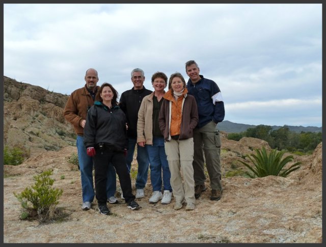
I started this blog at the urging of friends and family in April 2010 when my husband and I were given an opportunity to relocate in Maryland for one year. We have now returned home to Arizona and continue to walk by faith as we watch God orchestrate the adventures in our lives. I invite you to share in our adventures as we watch God at work!

We live by faith, not by sight. 2 Corinthians 5:7


Sunday, January 29

2 and 83/100... a tale of trails

Not wanting to have all the fun by ourselves, last weekend a group of friends went with us to explore two more items on my "100 Things in Arizona" list- both are things I've always "meant" to do but haven't until now.  Our first stop was  the Boyce-Thompson Arboretum (#2) on US 60 between Gold Canyon and Globe.

MR KLUD
photo by Mike
Mike, Laurie, Richard, Kristin, Ursi & Doug (also known as MR KLUD)

It was a cool, slightly overcast morning as we headed out on the Main Loop Trail. The path is lined with a plethora of plants including many we didn't recognize. Fortunately, quite a few of them have signs identifying them so we were able to get some ideas for our yards.

flora/fauna collage
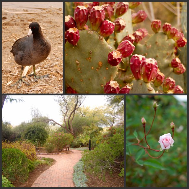
Even in winter the arboretum is full of green plants... and some of them are blooming!
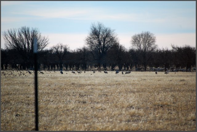
We thought this coot (the bird...) was a hoot with his huge green feet. He's a lake swimmer but doesn't have webbed feet.

Another nice feature at the arboretum is the abundance of benches along the paths. It's a great place to hike, but it's also a great place to just sit and be still... to meditate... to soak in the beauty of God's Creation.

bench collage
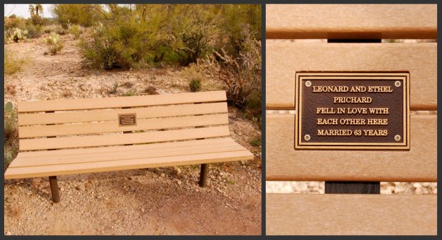
There are wrought iron benches, composite benches made of recycled materials and wooden benches. Many of them have been donated in memory of a loved one or to commemorate an important event. This was my favorite one... love is, indeed, grand!

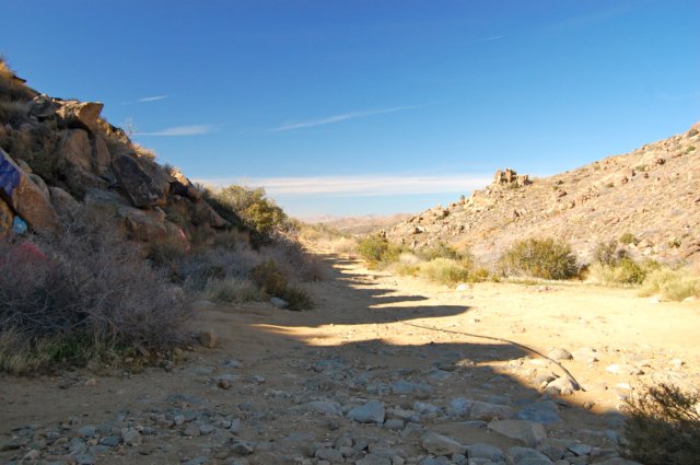
It was a great day to be outdoors. The first part of our hike was easy with paved paths part of way, then graded dirt paths. Interesting rock formations and creeks with water were cause to stop to marvel at this thing we call "nature." 

arboretum trails collage
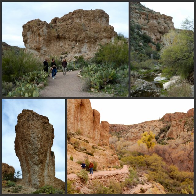
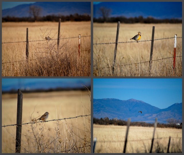
There was something new to look at around every bend!

fun!
photo by Mike
Can you tell we have fun together??

About 2/3 of the way into the Main Loop Trail we came to a suspension bridge over Queen Creek (yes, there actually is a real Queen Creek!). I am not a fan of walking across bridges of any type that sway or "give" when you're crossing over them. Mike was the first one on the bridge and it swayed and bounced as he crossed. Peer pressure can be a good thing; not wanting to seem a wimp, I stepped onto the bridge and crossed. The bridge bounced and swayed but I kept going. Half way across I stopped to look at the view... and realized that walking across the bridge really wasn't so bad.  

suspension bridge

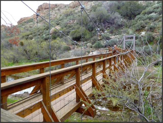
The Main Loop Trail continues on the north side of Queen Creek before crossing over the bridge. We opted to take the High Trail (designated a "difficult" trail but it wasn't that bad) which began just across the bridge. This trail was rocky and narrower as it climbed along the side of a mountain- and totally worth it for the views! 

After returning to the Visitor's Center, the guys decided to do a plant hike with an Australian botanist while the gals did the Australian Trail tour (it was Australia Day!). Both tours were enjoyable. All that hiking made us hungry so lunch was the next order of business. We had a delightful Mexican food lunch at a hole-in-the-wall place in Miami (Guayo's El Rey) before Doug and Ursi had to head back home. Mike and Laurie continued with us (or us with them?) on our second adventure.

Apache Trail map

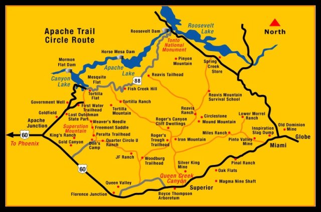
The general route of the Apache Trail (#83) has been used for centuries by several different Native American tribes and has at times been known as the Tonto Trail and the Yavapai Trail. The original roadway, completed in 1905, began at a Mesa railhead and ended at the Roosevelt Dam site on the Salt River covering a distance of 62 miles. Today, the Apache Trail begins in Apache Junction and ends at the intersection between Globe and Miami on US 60. We traveled the Apache Trail from the Globe/Miami intersection to Apache Junction. 

Apache Trail

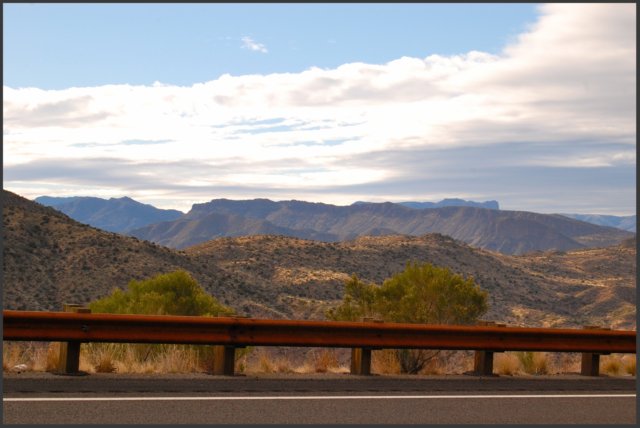
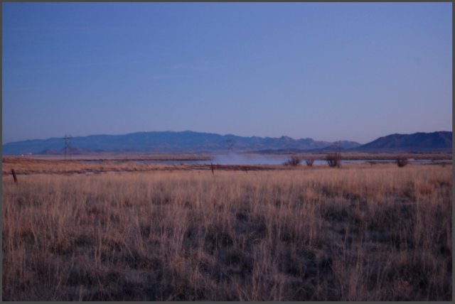
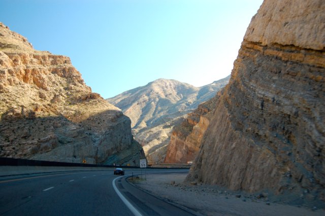
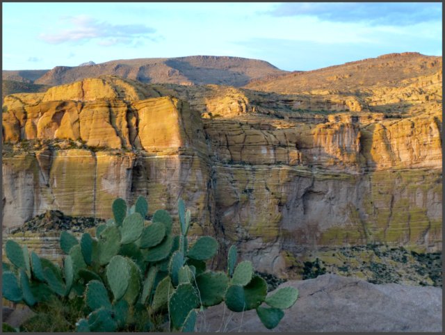
The paved road from the intersection of U.S. 60 and Globe/Miami provided a smooth ride as we watched the terrain change from gently rolling hills to mountains and canyons. The sunlight played along the mountains highlighting ridges and creating shadows as we were presented with one outstanding view after another.

Roosevelt Lake

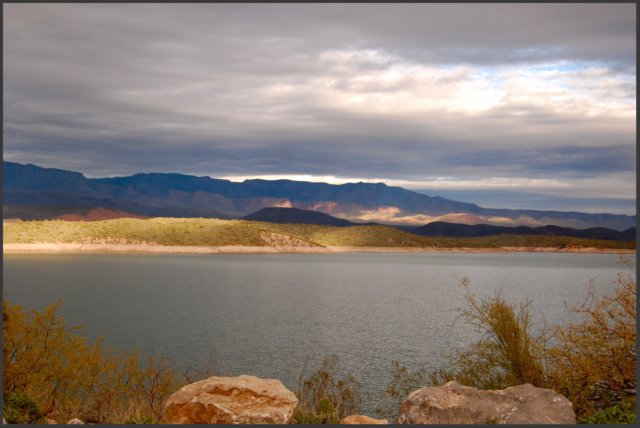
Soon we could see Roosevelt Lake, the largest of the lakes on the Salt River. 

Roosevelt Dam

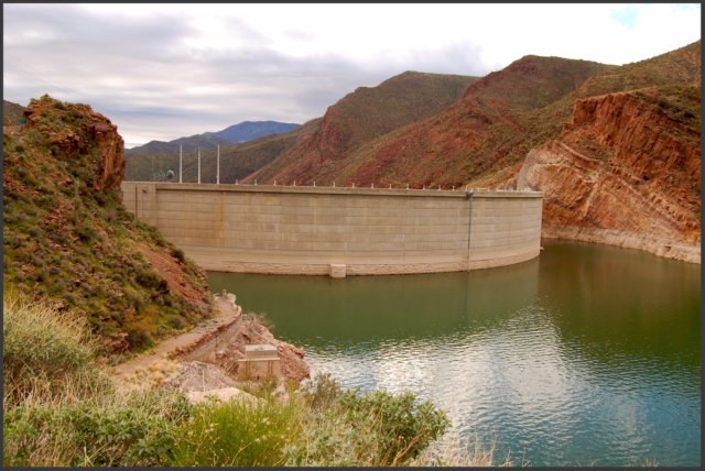
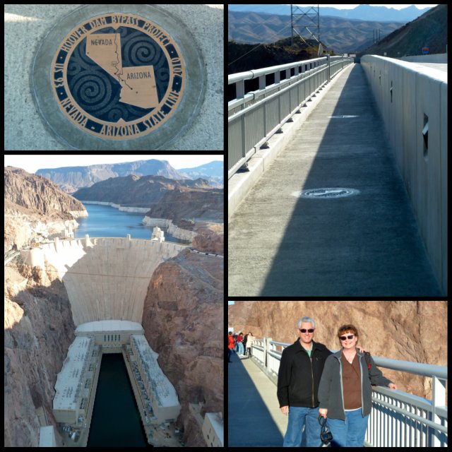
And the we came to the dam that created Roosevelt Lake. Construction of Roosevelt Dam began in 1905 and was completed in 1911. It was the world's largest cyclopean masonry dam, a Greco-Roman style of building that uses huge, irregular blocks. In the early 1990's the height was raised 77 feet and the entire dam was resurfaced with concrete. 

Roosevelt Bridge

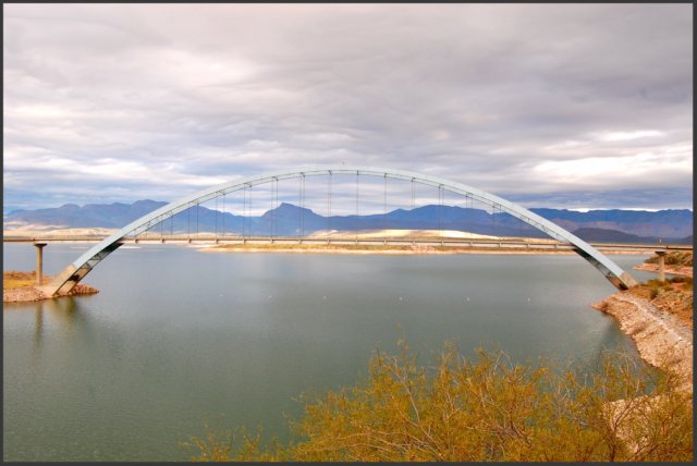
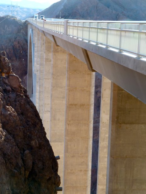
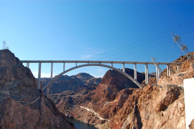
At the same time the dam was remodeled, a bridge was constructed just upstream of the dam due to safety concerns with vehicle traffic crossing on top of the dam. In November 1995, the Rossevelt Lake Bridge was named one of the Top 12 Bridges in the Nation along with the well-known Golden Gate Bridge and Brooklyn Bridge. It is the longest two-lane, single-span, steel-arch bridge in North America spanning 1,080 feet across Roosevelt Lake. Impressive? YES!


dirt road collage

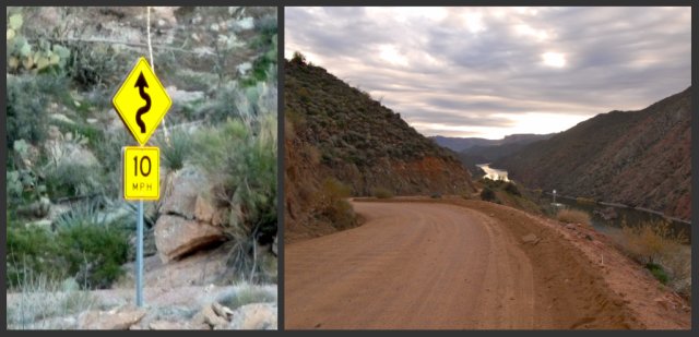
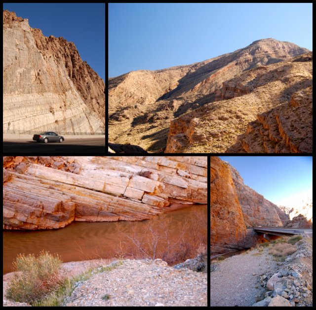
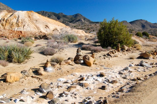
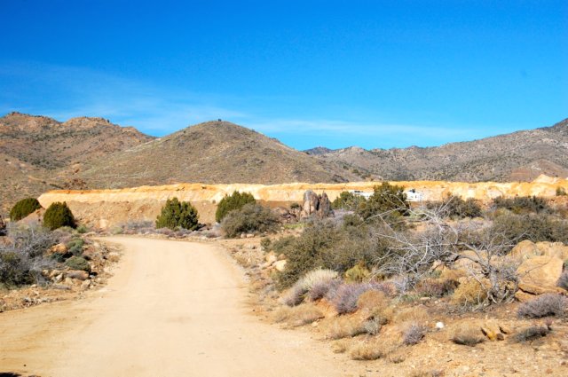
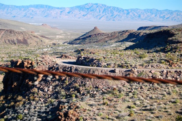
Just west of Roosevelt Dam we began the 22-mile stretch of dirt road that hugs the side of the mountains as it weaves its way through the canyons and valleys. We followed the Salt River as it came out of Roosevelt Lake. It quickly became a wide river before backing up into Apache Lake.


scenic views

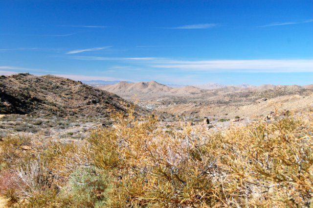
The panoramic views were breathtaking. I think President Theodore Roosevelt hit the nail on the head when he said, "The Apache Trail combines the grandeur of the Alps, the glory of the Rockies, the magnificence of the Grand Canyon and then adds an indefinable something that none of the others have, to me, it is most awe-inspiring and most sublimely beautiful." (1911)

Fish Creek Bridge

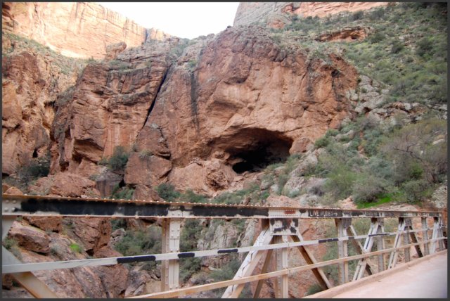
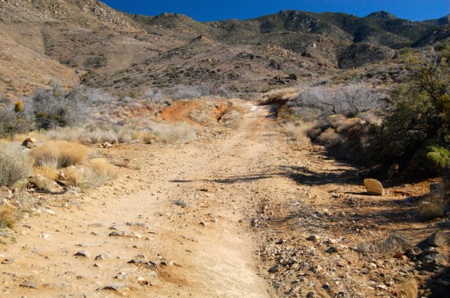
As we crossed Fish Creek, we wondered what lived in the cave. And then we began the ascent up Fish Creek Hill where the road hangs on the side of a high-walled canyon. 

top of Fish Creek Hill

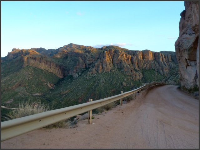
From the top of Fish Creek Hill we could see parts of the road below that we had just traversed. This section at the top had a tiny guardrail, but most of the road did not. It is not a two-lane road so passing oncoming traffic was an adventure with one vehicle pulling over to allow the other to pass. It's definitely an E-ticket ride!

scenic view 2

As we continued on the dirt road I could imagine cowboys and Indians racing along the trail on horseback or dusty prospectors searching for the mother lode in the scenic canyons. Could the road be paved? Certainly. But I think it would be a huge mistake; it would take away from the beauty of the experience. People would hurry along missing the subtle nuances of the trail. 

sunset

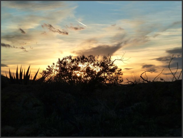
Just before we reached Tortilla Flat (and paved road!), the sun began setting. We stopped for dinner at Tortilla Flat followed by a prickly pear ice cream cone and then continued on the remainder of the Apache Trail. We had done that portion (from Apache Junction to Tortilla Flat) MANY times as it is one of our favorite Miata drives so we weren't disappointed to be doing it in the dark. We could see lights twinkling on Canyon Lake and even some stars before we approached the city. It was a perfect end to a great day! 

Thumb Up or Down: Absolutely Thumbs UP!
Miles Round-Trip: 168.0 miles
Miles To Date: 2982.7 miles
Percent of List Completed: 27%
Date of This Trip: January 21, 2012

Thursday, January 19

too casual??

Through the decades we, as a society, have become more casual in our attire. Most of the time, I think it's a good thing. Cleaning house in high heels and pearls like June Cleaver is just silly. Girls wearing dresses to school have a hard time playing on the jungle gym.  Having to wear pantyhose when it's 115 degrees outside is cruel and unusual punishment.

But occasionally I see something that just stops me in my tracks.

jammies & robe

If I was the Fashion Police, I would say that nothing even remotely goes together including her slippers. Aside from that, I tried to imagine what would cause a grown woman to wear jammies and a robe to the grocery store in the middle of the afternoon. Too sick to even pull on sweatpants and a t-shirt? A sorority hazing? A dare? 

Surely this must be such a rare occurrence that you wouldn't see it again in your lifetime.

Oh... wait...

jammies

Fast forward a couple of weeks to lunchtime at a fast food restaurant. The woman on the right has slippers  while the one on the left has a matching button-up pajama shirt. This is definitely sleepwear. And yes, they came in together.

This magnified casualness got me to thinking about things I'm increasingly more casual about. Like taking friendships for granted at times rather than actively participating in them. Or smiling and saying nothing rather than defending a Christian worldview. It's easier to be lazy, lounging around in indifference.

I think it's time to get dressed.


Tuesday, January 17

19, 56 and 31/100... birds, blarney and a brig

What is freedom? The ability to go wherever you want? Or to do what you want? Or just the absence of restraints?  I spent some time last weekend thinking about freedom as we visited three places in the southeast part of the state from my "100 Things in Arizona" list: Wings Over Willcox (#19), the "Thing" (#56) and the Clifton Jail (#31).

WOW!! What an absolutely awesome, spectacularly stunning, knock-your-socks-off kind of morning we had at the Wings Over Willcox (WOW) celebration! The wings refer to the feathered kind, not the man-made ones with ailerons. In my younger days I thought "bird-watching" was for "old" people but now I am one of them... a bird-watcher, not an old person!

In particular, we went to see the more than 30,000 sandhill cranes that "winter" in the Willcox area. They begin arriving in Arizona in late September and remain until mid-March when they return to the northern U.S., Canada and even Siberia. Some species are as tall as five feet with a wingspan of six to seven feet! In other words, they are impressive birds!

pre-dawn
Our day began waaaaay before sunrise* when we arrived at a manmade lake where the cranes sleep- no predators in the lake! It was short ride (in a school bus!) to the parking area and then about a half mile walk to the lake. (*It looks light only because of the 2.5 second exposure.)

Just as the sky began to pink up, we heard rustling and vocalizing that sounded like "kar-r-r-o-o-o   kar-r-r-o-o-o!"

flight #1
Soon, the first wave lifted off... graceful and beautiful.

flight #2
And then another wave! Hundreds of them! Keep in mind these birds are about FIVE feet in height!

flight #3
We could hear the flapping of wings and their song as they spiraled higher and higher. Incredible!

flight #4-ed
Each wave was more impressive in size and sound than the previous one. 

flight #5
It was like a carefully choreographed dance as they flew close together but never bumped into one another... swooping and soaring... before heading off to breakfast.

in flight
And yes, Alfred Hitchcock's "The Birds" did flash in my mind a few times!

sky writing
At times it looked as though they were "writing" a message in the sky!

close up
They are impressive birds... agile and powerful.

tranquility
Wave after wave lifted off as the sun crept closer to the horizon. It was incredibly quiet except for the birds "talking" and flapping... very tranquil.

layers of cranes 2
Mist continued to rise off the lake as the last late-risers took off.

nearly sunrise
What freedom as they flew through the sky!

sun coming up
By the time the sun hit the mountains off in the distance, all the cranes were air-borne. In less than 15 minutes, we watched thousands of sandhill cranes ascend and fly away to their favorite "breakfast spot!"

We walked back to the bus and headed to the breakfast spot of choice for sandhill cranes- a harvested cornfield! They eat the vegetation and also the rodents that inhabit the fields.

bird breakfast
The little specks are smaller birds flushed out of the brush. The cranes are people-shy so we stayed pretty far back.

other birds collage
Our guides identified other birds for us but the only one I remember is the peregrine falcon (lower right). We enjoyed the serenity and beauty as we watched birds flying freely in the sky.

After fueling up with more coffee, it was time to backtrack a bit to Benson... and "The THING!" Billboards cautioning you not to miss "The THING" are everywhere in Arizona and it was time we saw it for ourselves. How wonderful we live where people have freedom to promote their business!

Thing Building
Back behind the gift store at a truck stop are three tin sheds. "The THING" is in the last one.

foot print
For just one dollar you can enter the first shed and follow the yellow footsteps until you reach "The THING." The first two shed are filled with "antiques" and exhibits. 

THE Thing
This is the sign just above "The THING"- if you want to know what it is, you'll have pay a buck just like everyone else. I will say, it is worth a buck =)

After our quick stop at "The THING," we were on our way to Clifton to see the Rock Jail (#31). Nothing makes one think about freedom more than having it taken away. 

Clifton is one of three mining towns in close proximity that boomed in the 1860's when copper was discovered. Morenci and Metcalf were soon swallowed up in the ever-expanding open-pit mine (Morenci was later rebuilt) so Clifton was home to the rough and rowdy miners and others who passed through town. The need for a "detention facility" quickly became apparent and the mine hired Margarito Verala to construct one. 

Verala wisely decided to take advantage of the town's other natural resource (cliffs!) in making the jail. He bored straight in to the side of a cliff and carved out two cells. They shared a grated door and a narrow grated window. It was in use for many years with no escapes. The ironic part of the story is that its first prisoner was Margarito Verala, its builder! He indulged in a little too much "celebrating" at the dance hall after finishing a laborious contract job and after shooting the place up, was promptly arrested and thrown into the clinker!

Clifton Jail collage
We walked down into the cells... definitely not the place I'd want to frequent! The outside, however, was covered with beautiful rocks, kind of like a mosaic- perhaps a reminder of the freedom its inhabitants were missing.

Thumb Up Or Down: Three Thumbs UP! (yeah, even The THING!)
Miles Round-Trip: 546.3 miles
Miles To Date: 2814.7 miles
Percent of List Completed: 25%
Date of This Trip: January 14, 2012

Friday, January 13

17, 69, 4, 34, 9/100... beauty and charm in unlikely places

Someone once said, "Beauty is in the eye of the beholder." I think the same thing could be said about charm. Last weekend we visited a few things on my 100 Things in Arizona list in odd sounding places (the Arizona Strip, Chloride and Oatman) that some would pass by without giving a second glance  but we found rich in beauty and charm.

A small segment (29 miles, to be exact) of I-15 passes through the northwest corner of Arizona in what is called the Arizona Strip. It is the road one would use to get from Las Vegas to Utah (and the one we used to get to Zion National Park) and is heavily traveled by truckers as well as passenger vehicles. It is also a scenic drive through the Virgin River Gorge (#17)... if you pause long enough to enjoy the uplifted rock towering high above you and the river snaking its way through the gorge.

Virgin River Gorge
Anticline? Syncline? Or both?

We crossed the Virgin River, a tributary of the Colorado River, several times as it snaked its way through the bottom of the gorge. We finally found a place to pull over so we could catch more than a fleeting glimpse of it as well as take in the beauty of the mountains.

VR Gorge-ed collage
These mountains reminded me of Isaiah 54:10 "For the mountains may move and the hills disappear, but even then my faithful love for you will remain..."

Next up was the Mike O'Callaghan-Pat Tillman Memorial Bridge (#69) which crosses the Colorado River bypassing Hoover Dam at the Arizona-Nevada state line. We saw the bridge in varying stages of construction over the past several years but this was the first time we saw it completed. What an engineering feat! 

O-T Mem. Bridge
Standing in Nevada looking across to Arizona

The bridge honoring Pat Tillman, a war hero and all-star pro football player from Arizona, and Mike O'Callaghan, a war hero and beloved governor from Nevada, was built to alleviate traffic congestion over the dam as well as for safety and homeland security reasons. It is the first concrete-steel composite arch bridge built in the U.S. and at 840 feet above the Colorado River, it is the second highest bridge in the U.S. The Royal Gorge Bridge (Colorado) is 955 feet above the Arkansas River. Costing $114 million, it took twelve years from planning to completion.

The 1,900 foot long bridge has a pedestrian walkway on the dam side to allow tourists to view both the bridge and the dam in a leisurely fashion. While most of the people we saw only walked half way across to see the dam, we walked the entire length of the bridge to get a feel for how long, how big it is. Besides, the view IS different from each side!

O-T Bridge collage
The thrumming from the generators over half a mile away is quite noticeable- as are the numerous power lines! And yes, we stood with one foot in Nevada and the other in Arizona!

O-T Mem Bridge (span)
You can still drive over Hoover Dam or park on either side and tour the dam. The best views of the bridge are from the dam.

After spending a couple of hours at the bridge and the dam, we were back on the road headed for our next destination- the curious mining town of Chloride located north of Kingman just four miles east of US 93. There were two things I wanted to see in Chloride: the Purcell Murals (#4) and the "Junk Art" (#34). We stopped at the general store/welcome center to get more water bottles and directions to the murals. The very friendly but scruffy-looking proprietor told us we had to hike about a mile and a half to see the murals... unless we had a high-profile, 4-wheel drive vehicle... which we did not.

So we started hiking...

Hike

Previous hikers made interesting-looking rock statues along the way. Richard informed me they are called cairns.

Hike-1

We hiked down the road... and it certainly didn't look like you needed 4-wheel drive. We began to wonder if the guy was having some fun with the tourists...

... but we continued hiking...

Hike-2

Okay, this looks a little "rougher" but my car would have made it... 

"Are you sure we're going the right way???"

Hike-3

Confirmation we were going in the right direction was encouraging...

Hike-4
... and then the road got rougher... and steeper...


... and then I turned around and looked behind us... see how far away the town is... we started hiking at the lower right edge of town! 

Hike-5

What had we gotten ourselves into? Surely they must be just around the next bend...

Hike-6

Several bends later we found another marker and once again were encouraged we were on the right trail. And at this point, we'd gone too far to just turn back...

Hike-7

Are you kidding me? This is a road?

Hike-8

And you'd really think I would have learned not to look behind me... although it was a beautiful day for a hike.

Hike-9

Finally, we went around a small bluff and...

Found it!

... there they were!! WE FOUND THEM!!!! 

the big picture

In 1966, Roy Purcell took a break from college where he was studying art and became a miner in the mines near Chloride. While he was there, and with the support of local residents, he painted "The Journey," a 2000 square-foot set of murals on these boulders. In 2006, he returned to Chloride to restore the faded murals; today they are bright, vibrant and beautiful. Incidentally, it was the murals that eventually launched his successful career as an artist!

petroglyph

Amazingly, alongside the murals are petroglyphs from long, long ago. Artists from different centuries using the same rock canvas!

murals collage

So were the murals worth the hike? Definitely!! They are unlike anything I've ever seen. After spending a half hour admiring both God's Creation and man's creation, we were ready to head back. And,not surprisingly, the hike back was faster!

As we drove out of town, we stopped to see the "Junk Art" in each of the twenty or so homes in town. Most of the town residents are artists and recycling everyday objects into art is sort of a hobby for them. As they say, one man's junk is another man's treasure!

yard junk collage
Do you think our HOA would go for this?? I kind of like it!

Our last stop before leaving Chloride was the town cemetery. The first thing we noticed was how well cared for it was... and that every grave had an American flag... even though it wasn't a "patriotic holiday."

Chloride Cemetary

And then you couldn't help but notice the "Junk Art" decorating the graves. I don't think it is a show of disrespect but rather celebrating the life of the person buried there. One grave had a coffee cup... I imagine its occupant was a lover of the coffee bean. Others were decorated for various holidays... probably the loved one's favorite.

cemetary collage
I must admit, I rather like this grave decor!

It was past lunchtime by the time we were on the road to our next stop- a small mining town on Rt. 66 between Kingman and Bullhead City. Oatman (#9*) is a bit of a touristy spot known for its wild burros that roam the streets. The road to get there is not for the faint-hearted... we were wishing we had brought the Miata- it's THAT kind of road! More than once I found myself leaning to the center of the car!

Rt 66 to Oatman
The views are spectacular!

The burros were brought to Oatman to haul ore carts in the mines. When the mines closed, the burros were let go and now 3,500 burros roam the mountains around Oatman with 15-25 coming into town during the day. Local merchants tell stories about the burros as they sell bags of carrots to tourists so they can feed the burros.

burro collage
They look so sweet and docile... but they are wild and do bite and kick if you're not careful.

Oatman was also the locale for several movies such as How the West Was Won and Foxfire. Clark Gable and Carol Lombard honeymooned there in 1939 and their honeymoon suite at the Oatman Hotel is still a tourist attraction (it was closed for refurbishing when we were there). 

Oatman Hotel
The Oatman Hotel is the oldest  two-story adobe structure in Mohave County. The lobby is filled with antiques from its heyday.

We enjoyed lunch in the Oatman Hotel Restaurant- a charming place with good food and friendly servers. Although Clark Gable often played poker in the adjoining bar, we had no celebrity-sightings!

Oatman Hotel Restaurant
It reminded  us of the Tortilla Flat Restaurant... for obvious rea$on$. They estimate $80,000-100,000 cover the walls here!

After our late lunch, it was time to head home. We had a delightful time exploring some little-known gems off the beaten path.

Thumb Up Or Down: UP X 5!!!!
Miles Round-Trip: 1,059.2 miles
Miles To Date: 2268.4 miles
Percent of List Completed: 22%
Date of This Trip: January 6-8, 2012