I started this blog at the urging of friends and family in April 2010 when my husband and I were given an opportunity to relocate in Maryland for one year. We have now returned home to Arizona and continue to walk by faith as we watch God orchestrate the adventures in our lives. I invite you to share in our adventures as we watch God at work!

We live by faith, not by sight. 2 Corinthians 5:7


Saturday, June 30

40/100... the land that time forgot (Canyon de Chelly)

In the far north-east corner of Arizona, on the Navajo Indian Reservation, is a beautiful canyon I would venture to say most Arizonans have never seen. Canyon de Chelly (pronounced "canyon de shay" and #40 on my "100 Things to See in Arizona" list) is not nearly as large or grandiose as the Grand Canyon, but it is just as breath-taking.

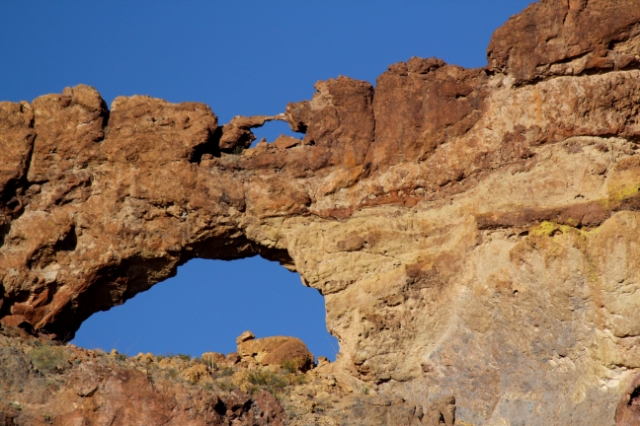
President Herbert Hoover, by presidential decree, made Canyon de Chelly a national monument in 1931. Visitors can see the wonderful views from top-side and peruse the Visitor Center at no charge. But going into the canyon is restricted to only those with a Navajo guide.

We met our guide, Oscar Bia,whose last name was "Americanized" during a US census, at the Holiday Inn in Chinle (just outside the park). His translated Navajo name is "Boy Who Runs in Canyon" but we just called him "Oscar." We loaded our gear (mostly water bottles!) in his 4-wheel drive suburban, obtained a permit from the US Park Service and headed into the canyon. Once we passed the entrance booth into the canyon, the paved road ended and dirt and sand ruts as deep as cantaloups began. Oscar engaged the 4-wheel drive and we were off for an adventure!

entrance to canyon
The rock sides of the canyon start at just a few feet high and gradually become taller and taller.

As we drove, Oscar told us about himself, his family and his people. He has lived in the canyon all his life. His parents and siblings moved to New Mexico when he was about eight but he stayed with his grandparents in the canyon. His grandfather taught him the old ways but also insisted he go to school so he could write the stories down. Navajo history was an oral one until very recently. Young people today are not learning the Navajo language so their history must be written before it is lost forever.

petroglyphs
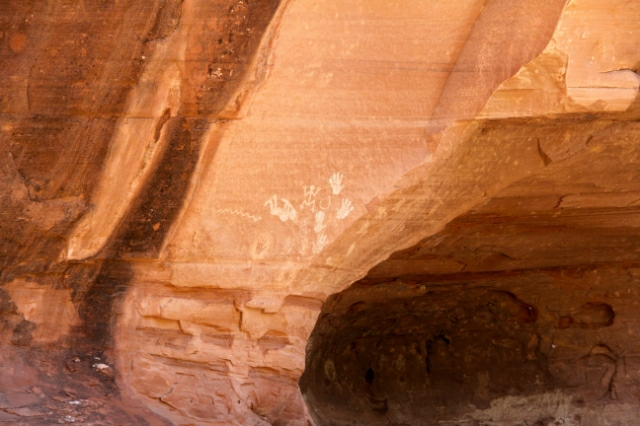
We saw many petroglyphs on the walls of the canyon. Oscar explained that some were done by the "Ancient Ones", some by the Hopi Indians who also lived in the canyon for a time and some by the Navajo Indians. The ones that look like hand prints are "signatures" and indicate that different people (clans) lived there.

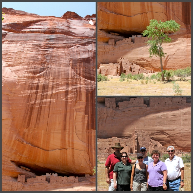
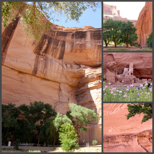
We saw many cliff dwellings of different sizes and designs. From the time he was a young boy, Oscar spent his days exploring the canyon, including all of the cliff dwellings and the many side canyons. He learned from an early age to climb up the sides of the canyon; it was how he got to his school bus stop!

downstairs cliff dwelling
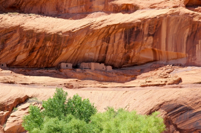
Some of the cliff dwellings were just a hundred feet or so off the canyon floor.

2-story cliff dwelling
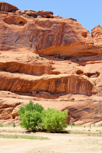
And sometimes there would be one even farther up- almost like a 2-story dwelling. Oscar said usually it was because water flooded the canyon and they had to climb to higher ground. Notice how they are situated under rock outcroppings- shelter from rain and wind.

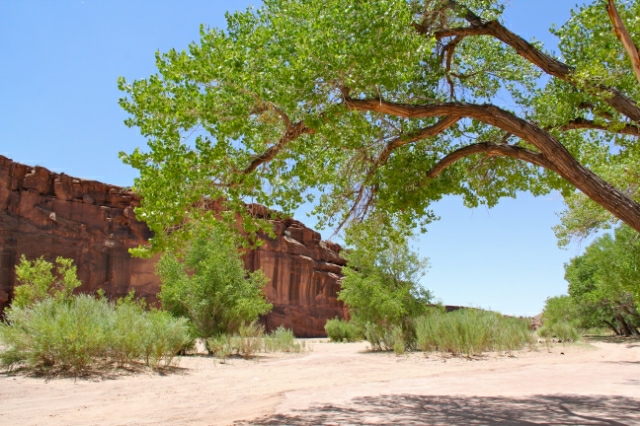
Most of the big trees are cottonwoods... and they were in full "cotton production" when we were there. The fluffy "cotton" was floating everywhere getting in our hair and eyes. 

Cottonwoods Collage- resized
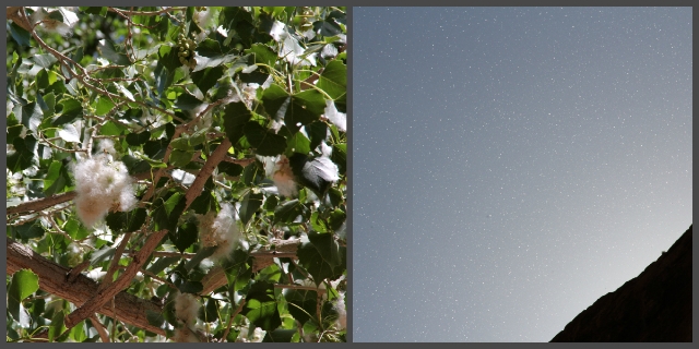
The fluffy "cotton" is actually the fruit of the female cottonwood trees and carries the seeds as the wind blows. Although it is a nuisance, the cottony fluff has no allergenic properties. If you look closely at the photo on the right, you can see the fluff floating in the air.

We stopped quite a bit along the way as Oscar regaled us with stories; some were stories handed down from generation to generation about the "Ancient Ones" and others were stories about his life growing up in the canyon. He told us that as a young man, he was exploring some ruins in Canyon del Muerto, a side canyon with a history of death. At one time, the Mexican Army was looking for gold when they ran into a young boy who was running from an abusive father. The Army tried to help him but ended up in a massacre with many of the soldiers getting killed or wounded. Inside one of the ruins Oscar found a skeleton leaning up against the wall dressed in an Army uniform and still clutching his rifle. 

cliff dwelling Collage- resized
The canyon walls have many stories. I wondered about the people who walked the floor of the canyon hundreds or thousands of years ago. Were their lives similar to mine- raising a family, enjoying friendships? And how were they different? I am quite certain they were in better shape than any of us since they climbed to the top of the canyon regularly!

There were only two stops that had any "retail business." The Navajo make beautiful jewelry and I was happy to find a couple of stands with local artisans. Laurie, Ursi and I all found some jewelry we liked. I especially enjoyed talking to the woman who made the necklace I got for our granddaughter. As she shortened it, she told me the meaning of the stones and what they represented. 

snack stop Collage- resized
This stop was shaded by the canyon walls and was cool and refreshing. In addition to the jewelry stands, there was also a food concession selling Indian fry bread- a tasty treat white people cover with powdered sugar. The Navajos selling the fry bread told us they eat it with salt, not powdered sugar, although they had both available. After trying it, we agreed it was a tastier combination!

That was our last stop and as we headed back out of the canyon, Oscar continued to tell us stories... about being a guide for archeologists and anthropologists and how, in his experience, they didn't listen to the tribal elders  but made their own interpretations. Hollywood has made two movies in Canyon de Chelly- Mackenna's Gold (1969) with Gregory Peck and The Lone Ranger (coming out summer 2013) with Johnny Depp. Oscar was the guide for the movie crew filming The Lone Ranger and he said Johnny Depp sat in my seat!! Oscar also said he wouldn't talk to him until Oscar threatened to make him walk out!

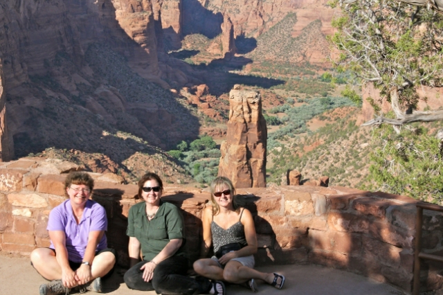
We greatly enjoyed our guided tour of the inside of the canyon- it's definitely worth doing! There are half a dozen or so licensed guides- you can find Oscar at Canyon Ancient Jeep Tours. After bidding farewell to Oscar, we ventured along the canyon topside to get an entirely different perspective.

topside
"Canyon de Chelly- a spectacular sculpted petrified sand dune created by wind and water!"
(from Oscar's business card)

guys
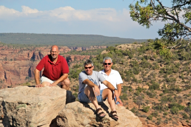
Boys will be boys (at any age) and climb on rocks whenever they get a chance!

The Navajo culture is matriarchal. Oscar told us that just about all women are your "aunties" and like Jewish people, the "bloodline" is through the mother. In ancient times, they had several deities and quite a few were women. Holy Spider Woman was an important deity as she taught the people to weave.

spider rock
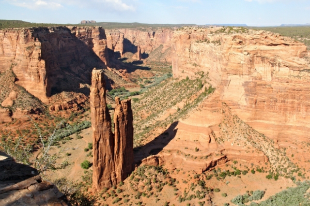
The huge monolith rising from the floor of the canyon is "Tsé Na'ashjééii"- or Spider Rock in honor of Holy Spider Woman. 

gals
No rock climbing for us- but we did wonder how difficult it would be to climb Spider Rock since being on the top of it would be an awesome photo!

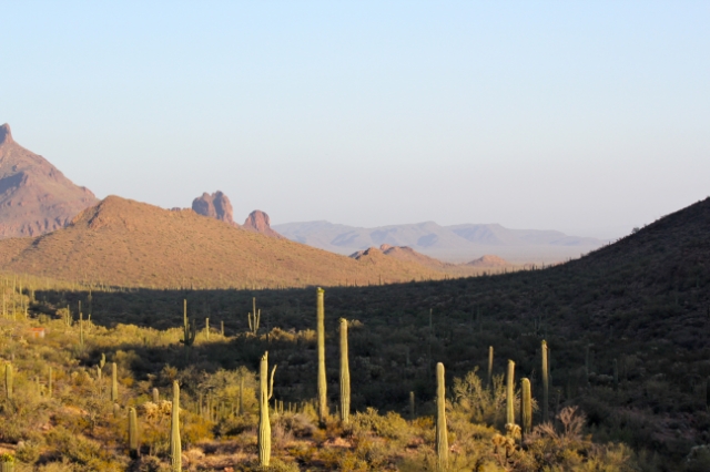
When we were finished at Canyon de Chelly, we hurried to the Petrified Forest and by default, the Painted Desert. As we were driving south through the Navajo Reservation, most of which is not fenced, we saw a variety of "wild life" on or very near the road: a deer meandered across the road before effortlessly leaping across a fence, a baby horse grazing by the side of the road (mama did not look concerned at all), two cows- one of which required us coming to a complete stop before he decided to move along. But the funniest sight was a pack of eight or ten dogs- mutts of every size, age and description- that were running along the opposite side of the road before deciding to cross the road... first the "leader"... then a couple of smaller dogs... and a few more... and another one... a couple more came across... and then the "old man" struggled across the road, limping a bit as he went, stopping to rest in the middle while ALL the other dogs sat and watched (encouraged?) him from the opposite side. When he finally made it across the road, the other dogs got up and continued on their way with the "old man" bringing up the rear. 

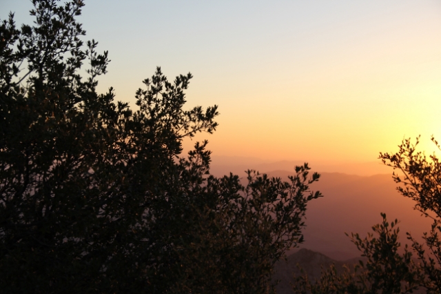
We finally made it to the Petrified Forest (which we weren't officially going to until the next day) and made our way to Kachina Point to watch the sun set on the Painted Desert which runs along side the northwestern part of the Petrified Forest.

sun peeking through
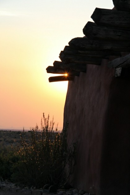
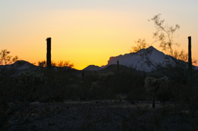
The sun was peaking between the eaves of the Painted Desert Inn, an old Fred Harvey inn that now houses a gift shop and snack bar, as we arrived.

sunset
The sun dipped lower and lower on the horizon, illuminating the colors of the Painted Desert as it went down.

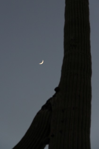
And then it was dark. What a beautiful and peaceful way to end our day!

Thumb Up or Down: UP!!!!
Miles Round Trip: see next post
Miles To Date: see next post
Percent of List Completed: 61%
Date of This Trip: June 15-17, 2012

Friday, June 29

11 and 71/100... timeless treasures (Winslow)

Johnny Cash sang about it in his song, "I've Been Everywhere." The Eagles made it famous in their song, "Take It Easy." What is it about the tiny town of Winslow, Arizona that captures the hearts of songwriters  and Americans? We decided to find out.

In 1972, the Eagles sang "Well I'm standin' on a corner in Winslow, Arizona, such a fine sight to see; It's a girl, my Lord, in a flatbed Ford slowin' down to take a look at me..." The "Standin' on the Corner Statue" (#11 on my "100 Things In Arizona" list) was our first stop.

Statue
Bronze sculpture by Ron Adamson depicting Jackson Browne, co-writer of the song

Winslow was a booming town with the Burlington Northern & Sante Fe Railroad as well as Route 66 (aka "the Main Street of America") going through it. Hotels, motels, diners and shops popped up and flourished. In fact, business was so good  and the main thoroughfare so busy that Route 66 became a divided highway in Winslow (the first segment of divided highway for the Mother Road!) with east-bound traffic on Second Street and west-bound traffic on Third Street, both one way streets through town. 

Then, in 1978, Interstate 40 opened, bypassing Winslow. Always in a hurry, motorists and truckers preferred the high-speed, multi-lane modern freeway to the slower, two-lane highway of Route 66. The town struggled to survive as place after place went out of business. What had been the largest town in northern Arizona was slowly becoming a ghost town. 

Two things saved the town: the reopening of La Posada (keep reading for explanation!) and the Standin' On The Corner Corporation, a non-profit corporation dedicated to the restoration of historic downtown Winslow. Their plan? To capitalize on the Eagles' song with a park and make it a tourist destination.

Plans were submitted, artists commissioned and finally, a park took shape. John Pugh painted a mural on the side of a building, a statue was made, benches and signage arranged and a destination emerged. Advertising and promotion was the next step.

mural
The mural depicts the song's lyrics with the girl in the flatbed Ford. And notice the eagle in the top left window =)

The advertising campaigns worked. Soon people were crusin' into Winslow on their motorcycles, in a pickup truck and yes, even packed in minivans! MR KLUD was not the only group getting a photo at the corner- there was a constant stream of people, mostly baby-boomers who remembered rockin' out to the song in the 70's!

truck
Yep, the flatbed Ford is part of the park! 
Richard, Kristin. Doug, Ursi, Mike and Laurie
aka MR KLUD

I mentioned La Posada earlier as one of the two things that saved the town. What's ironic is that it also brought famous actors, politicians, artists and authors (read: MONEY) to the town in 1930 when it was built by the Fred Harvey Company, the owner of a chain of restaurants and hotels alongside railroads in the western states. La Posada (#71) was designed by world-renowned architect, Mary Jane Colter and is said to be her favorite work. It was our second stop.

La Posada
At a time when most Americans believed culture originated in Europe, Colter designed her building to reflect materials and history of the region. The design for La Posada comes from a Spanish hacienda with a smattering of Indian and Mexican touches. 

The hotel opened just as the Great Depression was beginning. Despite being a luxury hotel hosting the rich and famous of the day, it never prospered and eventually closed in 1957. Its museum-quality furnishings were auctioned off a few years later and a few years after that, it was gutted and turned into offices for the Sante Fe Railway. About three decades later, the railway announced it was tearing it down. 

After three years of negotiations with the railway, Allen Affeldt, Tina Mion (an artist and also Allen's wife) and Daniel Lutzick (their friend) became partners/owners of La Posada and began a $12 million restoration project. Against seemingly impossible odds, they are transforming a forgotten, broken-down building back into the beautiful, museum-like hotel is once was- Mary Jane Colter's legacy. 

The rooms are named for the famous people that stayed at the hotel. Hotel registers with room numbers were lost in a flooded basement but other records with names survived, so while the person your room is named for may not have stayed in that room, (s)he did stay at the hotel.

balcony
We stayed in the Clark Gable (one of my favorite actors!) room and had a small balcony.

Room Collage
Our room was very comfortable. Tina Mion's brother, Keith, designed, built and signed the headboard in our room. All the rooms had to be remodeled but were done in the same style as they were originally.

Much of the ground floor comprises common areas- a gift shop, restaurant (The Turquoise Room- which is fabulous!), sitting rooms with books and games set out on tables, a library, art gallery and museum area. We spent over an hour exploring the various rooms and realized we needed much more time. 

Interior of La Posada
This hallway is a treasure trove of goodies- some original and some from modern-time.

key cross
"The Cross at La Posada" (my favorite!) is a piece done by Daniel Lutzick. The keys were all ones found at La Posada- old room keys (and, by the way, they still use old-fashioned room keys!), maintenance workers' keys, luggage keys left by patrons, vehicle keys for corporate cars, filing cabinet keys, padlock keys for storage sheds, patron's lost keys...

We got up early the following morning to explore the grounds and watch the trains. The train tracks (four sets of them!) are behind the hotel and the freight trains pass by all day and all night. I thought they might keep us awake but I didn't hear them once!

backyard grounds
The "backyard" is beautifully landscaped- a peaceful retreat!

hollyhocks
Fuchsia, light pink, white and red hollyhocks were blooming everywhere.

Just past the "backyard" are the tracks and the old train station, which is now closed. Amtrak is the only train that stops and departing passengers are instructed to go into La Posada. 

Train Collage
Although the train station (upper left) is abandoned, the many chairs and benches (upper right) that line the track are often filled with people "sittin' a spell to watch the trains go by!" While Amtrak only passes by twice a day, mile-long freight trains pass by several times an hour.

After getting a cup of coffee to go- brewed just the way I like it!-  from the lobby, we headed out the front door to explore the many patios and gardens in the front. As she was designing La Posada, Mary Jane Colter wanted to ensure visitors would feel welcomed and at home as soon as they stepped on the premises. It has been said this was her favorite project because she got to design the grounds as well as the hotel itself.

courtyard
This patio in the front courtyard has great character and charm. The graceful arches, wood shutters and tile/rock floor reveal old-world hacienda elegance while the eclectic furnishings add an element of fun.

fountain
A refreshing water feature visibly and audibly separates the patio to the left from the gardens to the right. 

Garden beds filled with vegetables were intermingled with paths leading to another smaller patio area. I wish my vegetable garden looked as good as theirs! The garlic, chilies, onions and blue corn they grow are used by their restaurant chefs in The Turquoise Room. The "Spicy Green Chili Breakfast Potatoes" were absolutely incredible with just the right amount of heat.

I was strolling through the flower gardens on the other side of the entrance path and noticed a small building with an interesting closed door. I snapped a few photos and continued on my way when I ran into Mike. He asked if I had been in the Secret Garden yet... 

Garden Collage
What I thought was just a cute garden shed with an interesting door was actually the way into a secret garden lined with beautiful flowers (mostly hollyhocks, a favorite of mine!). Another small patio with an assortment of chairs overlooked the water feature and gardens. It was here that I finished my coffee, thanked God for an amazing morning and spent a few moments in quiet reflection.

Alas, we needed to get on the road early to head to our next destination, Canyon de Chelly, so our stay at La Posada was short. We all agreed that we will be back again someday to spend more time. They are almost always booked up so be sure to make reservations if you come!

As we drove out of town, we stopped at three local icons, each with a great story. 

Winslow Collage

Totem Pole: Peter Wolf Toth, a Hungarian sculptor who immigrated to the US, created 74 sculptures (wood carvings?) to honor Native Americans. There is at least one in each state and several Canadian provinces. Arizona's sculpture is located in Winslow.
Bulldog: This six-foot tall fiberglass figure was originally bought by a Winslow citizen to donate to the high school (they are the Bulldogs!) but instead placed it on a plot of land near the high school. It serves two purposes: alters traffic flow and intimidates visiting teams since they have to drive right past it to get to the high school!
9/11 Remembrance Garden: "United We Stand" declares a tribute to the citizens of the United States in the wake of the terrorist attacks on September, 11, 2001. The twisted pieces of steel on either side of the flagpole (which flies a flag flown at the Pentagon) are 14- and 15-foot high rusted steel girders from the Twin Towers in NYC- the largest debris pieces provided to any town in America.

Thumb Up Or Down: UP on both hands!
Miles Round Trip: see next post
Miles To Date: see next post
Percent of List Completed: 60%
Date of This Trip: June 15-17, 2012 

Saturday, June 23

really???

I like to peruse the SkyMall Magazine on the plane every so often... and usually come away wondering how the human race has survived this long.

The winner on my last flight was a product that at first left me shaking me head, sighing out loud and contemplating who would buy such a product.

Protica's "Protein Ketchup"- the first protein-fortified condiment
Each single-serve cup has 15 grams of protein, 0 grams of fat and two servings of tomatoes. 
The cost? $1.43/cup

It is no secret that most Americans are all about convenience and as a result, eat out pretty often. McDonald's sells over 1 million Happy Meals EVERY DAY in the United States. And that's just one of many fast food restaurants. Americans spend over $140 billion (yes, with a B!) each year on fast food.

As shocking as all that was to me, the factoid that really got me was this: The number one vegetable in America for kids is... FRENCH FRIES!! That's right... deep-fried starch is apparently a vegetable. And let's be honest- most kids eat the french fries first and then are "too full" for their chicken nuggets (another deep-fried food!). So maybe it is a good thing that someone had the foresight to add protein to ketchup... the number one dip for french fries. At least our children will get an actual vegetable (and yes, I know tomatoes are a fruit!) and protein with their "#1 vegetable!"


Friday, June 22

75/100... kitt peak national observatory

"Space: the final frontier..." Millions of Americans in the late 1960's tuned in each week to watch the "voyages of the Starship Enterprise" as they boldly went "where no man has gone before." Nearly every television set in the world was tuned in to watch Neil Armstrong and Buzz Aldrin (Apollo 11) land and walk on the moon on July 20, 1969. Every preschooler learns the song "Twinkle Twinkle Little Star..." Is it just human nature to be curious about the heavens and the sky?

During our trip to southern Arizona, we stopped at Kitt Peak National Observatory (#75 on my "100 Things To Do in Arizona" list) to get an in-depth peak at the night sky and the tools astronomers use to scrutinize it.

Kitt Peak National Observatory is about 56 miles southwest of Tucson on the Tohono O'odham Indian Reservation where about 200 acres in the Quinlan Mountains are leased from the Tohono O'odham under a perpetual lease agreement for as long as the facility is used for scientific endeavors. It took us about 45 minutes to get to the turn-off to ascend the mountain. As we turned off the highway, we noticed there were scattered clouds and an outside temperature of 71 degrees.

from a distance
The telescopes looked tiny way off in the distance.

Astronomers recognized a need for a national observatory in the 1950's and after a three year survey of over 150 mountain ranges across the United States, Kitt Peak was finally selected. Factors such as temperature, visibility, light pollution and access to an international airport were part of the decision-making process.

clouds on the landscape
We stopped at this view point about two thirds of the way up the mountain. It's easy to see why Kitt Peak was chosen!

flower
Beautiful Arizona thistles dotted the mountainside along the road. 

Finally, we arrived at the parking lot for the Visitor's Center. The clouds were increasing and the outside temperature was 52 degrees- a drop of 19 degrees from the base of the mountain! Kitt Peak National Observatory offers tours of three of their telescopes- we decided to do all three! First up was the McNath-Pearce Solar telescope- the world's largest solar telescope.

solar observatory
It doesn't look like a typical telescope, does it? The slanted piece is 200 feet long and extends into the ground (at the same angle) for another 300 feet. The angle is determined by the latitude.

Our docent (a retired engineer who volunteers at Kitt Peak) explained how the telescope works and then, at last, took us inside. I thought it was the most interesting of the three telescopes we saw since it is so different.

solar mirrors
The giant mirror, called a heliostat, tracks the sun. The light is reflected down the tunnel.

sun beam
Dust particles in the air allow us to see the light beam.

hard at work
Astronomers collect the data they need including recording the images. We've come a long way since Hans Lippershey's first telescope in 1608 and hand-made drawings of what he saw!

The telescopes at Kitt Peak are available for researchers and graduate students to use. They first complete a lengthy application explaining what they need, what data they hope to collect and when they need to use the telescope. A committee selects "the winners" (considerably less than half of the applicants) and assigns them a date and time. If it storms or the sky is covered with clouds on their assigned day/time and they cannot use the telescope, they must begin the process anew.

Dorm-type rooms and a cafeteria are available for the researchers/grad students to use. As most of the astronomers are working at night, "quiet hours" are generally during the day.

tennis court
A basketball court was built so researchers could get some exercise- but has become overgrown with weeds since no one wants to waste their allotted time "playing"- they are either working or sleeping for a few hours!

One of the issues that the Tohono O'odham people had when they were approached with the concept of building a national observatory on Kitt Peak is that it is their second most sacred mountain. According to their story, I'itoi (the creator) sometimes leaves his home on a neighboring mountain and comes to Kitt Peak to rest and relax.

sacred mountain
The cylindrical formation off in the distance is Baboquivari Peak where I'itoi lives. (Notice the clouds... I was getting a little concerned that we wouldn't be able to see anything once it got dark.)

One of the founders of Kitt Peak, a professor at the University of Arizona, had an idea that might persuade the Tohono O'odham people to lease the top of their second most sacred mountain. He invited the tribal elders to come to the university and showed them the heavens through his telescope. The tribal elders were amazed that they could see the stars, planets and moon (that are so much a part of their heritage) in such detail and they consented to lease the land strictly for scientific research- no military or commercial application. 

Kitt Peak was named by a Pima County surveyor, George J. Roskruge, in honor of his sister, Philippa (Roskruge) Kitt. "Kitt Peak" was officially adopted by the US Geographic Board in 1930.  The name for Kitt Peak in the O'odham language is "ioligam" which means "red stick", a reference to the many manzanita bushes.

manzanita tree
Beautiful manzanita bushes cover Kitt Peak.

Kitt Peak is home to 24 telescopes, each a different size or type. Since telescopes are very expensive to build and maintain, several universities or entities usually go in together to build one. We toured two other telescopes during the course of the day. 

aerial view
Be sure to wear comfortable walking shoes when you visit- the telescopes are spread out over the top of Kitt Peak! And notice that the clouds blew away- we had a clear sky for observing during the night!

There were several hours between the last tour and when the NOP (Nightly Observing Program) began- not enough time to leave the mountain and we forgot to bring our books to read. We napped for a bit in the car because the higher elevation (6875 feet) makes you sleepy <wink, wink> and then walked around the grounds. We watched birds and squirrels and had a snack.

angry bird
This "Angry Bird" tried several times to abscond with our bag of Cayenne Pepper Pecans but the bag was too heavy for him to lift. He finally gave up trying to carry it off and began using his beak to poke a hole in the bag. We shooed him off feeling that cayenne pepper probably wasn't good for him. 

Finally it was time for the NOP to get under way. We had a delicious box supper while we listened to a presentation and then divided into groups. First we learned to read a star chart, then learned how to use binoculars to observe the night sky. Finally, we had time at one of the telescopes to gaze at the moon, stars, nebulas, or whatever we wanted. 

sunset on kitt peak
We watched the sun set from the top of Kitt Peak- what a gorgeous view!!

After sunset, at twilight, we watched stars begin popping out into the night sky... first just a couple, then a few more. And, of course, the moon was visible. We used our binoculars to get a closer look!

man and moon

Finally it was time to use the telescopes; ours was a 16-inch reflecting telescope. Some telescopes are housed in domes but ours was in a flat-roofed building and the roof rolled to the side so we had a 360 degree view of the sky. It was incredibly dark with zillions of stars overhead.  Our star guide, a paid employee, pointed out stars, constellations, satellites, and planets before we used the telescope to find Omega Centauri (one of the biggest and closest star clusters), M81 (a small spiral galaxy), Venus, Mars, Saturn's rings, and a host of other things. 

As I listened to our docent explain that the Big Bang created the heavens and the earth, I felt sad. How could someone look up at the magnificent universe and not see the hand of God? 

"In the beginning God created the heavens and the earth. ... God made two great lights- the greater light to govern the day and the lesser light to govern the night. He also made the stars."
Genesis 1:1,16

All too soon (about 10:30) it was time to put the telescope away and head back down the mountain. There is a strict NO LIGHTS rule on the mountain after dark since it interferes with researchers observing and collecting data. In fact, they gave us red flashlights to use when we walked around. And of course, NO flash photography. And NO HEADLIGHTS!! They gave instructions for turning off all headlights and fog lights. If your car had lights that could not be turned off, they taped manilla folders over them. So... we were going down a steep mountain road with lots of curves and few guard rails... in the dark... WITH NO LIGHTS! They did have us caravan down behind one of their vans since they know the road well. As long as you stayed close behind the car in front of you, you would be fine. A few miles down from the peak, we all pulled over and were allowed to remove the folders from our headlights and turn them on. Yep- it was definitely an E-ticket ride!!

Thumb Up or Down: UP!
Miles Round Trip: 672.2 miles
Miles To Date: 5940.4 miles 
Percent of List Completed: 58%
Date of This Trip: May 25-27, 2012

Monday, June 11

33/100... organ pipe cactus national monument

Perhaps the most notorious thing Arizona is known for is wanting to protect its border with Mexico. SB 1070 garnered national and even international attention before making its way to the US Supreme Court. There are many reasons that proponents of SB 1070 feel so strongly about protecting our border- one is to stop or at least slow the flow of illegal drugs into our country. Many Arizona border towns have become unsafe due to the Mexican drug cartels.

Organ Pipe Cactus National Monument (#33 on my "100 Things to See in Arizona" list) is situated right on the border with Mexico in the west-central part of the state and has seen its share of violence in recent months. Parts of the park have been closed to visitors due to fighting among the drug cartels inside the park. Park rangers now wear flak vests and travel in pairs outside the Visitor Center.

Ten years ago, Park Ranger Kris Eggle was shot and killed in the line of duty while pursuing members of a Mexican drug cartel hit squad who fled across the border into the park after committing a string of murders in Mexico. There is a memorial in his honor at the Visitor Center, which, incidentally, is named after him. 

fallen park ranger
Kris Eggle
August 15, 1973 - August 9, 2002

Sixty-nine percent of the most remote regions of the park were closed to tourists after his death in 2002 as park rangers were forced to be de facto border patrol agents. A stronger border patrol presence led to portions of the closed part of the park reopening in 2009 for tours guarded by heavily armed park rangers. Then, in March of this year, more sections were reopened and the guarded tours discontinued as safety conditions improved and many more Border Patrol agents were added. 

border patrol stop
We went through this formal Border Patrol Checkpoint just outside the park. There are several similar checkpoints between the park and Tucson as well as a bevy of Border Patrol agents patrolling in vehicles. We appreciate their efforts to keep us safe.

We arrived on a beautiful late spring day ready to see some organ pipe cactus. The extreme southern part of Arizona is the very northern part of their natural habitat. I have seen them in botanical gardens or in people's yards where they can be watered during extreme heat or protected from frost but was looking forward to seeing these unique plants in nature. 

It was about 17 miles from the park entrance to the Visitor Center... and we only saw a handful of rather smallish organ pipe cacti. This was NOT a good sign! We did, however, see more ocotillo than we've ever seen in one place and thought perhaps it should have been called "Ocotillo National Monument!" 

My first question at the Visitor Center was "What is the difference between a National Park and a National Monument?" The answer: a National Park requires a congressional designation while a National Monument requires only a presidential designation. In other words, either 435 people have to decide... or one. Both are maintained by the national parks service. After watching a short video about organ pipe cactus, we were on our way to explore the two hour loop road (rather than the 4 hour one!) on the east side of the park.

Both loop roads are graded dirt roads so the going is slow! We drove about four miles (25 minutes!) before we finally saw an organ pipe cactus. This was definitely NOT a good sign! As we were discussing just turning around and leaving, we saw another... and then another.

organ pipe cactus 2
They really do look like organ pipes reaching upward!

While it looks like several cactus trunks clustered together, organ pipe cactus actually have several narrow (which in cactus measurement means about six inches!) stems that rise vertically from a very short trunk just above the ground. The stems generally grow to heights of about 16 feet but some reach heights of over 25 feet. Unlike saguaro cactus, organ pipe cactus stems rarely branch.

As the dirt road got closer to the mountains (the Ajo Range), the number of organ pipe cactus increased. Although it took about an hour or so of drive time before we began to see many, it was well worth the drive!

organ pipe cactus 1
Although only about 100 miles (as the crow flies) separates them, the desert landscapes at Saguaro National Park and Organ Pipe Cactus National Monument are very different!

Several times we pulled over as far as we could on the dirt road and got out to explore the area. As far as we could tell, we were the only ones on the loop and it was eerily quiet when we first got out of the car. Then, slowly, the birds would begin to sing. 

birding
Who would have thought we would become birders???

birds Collage
We watched a raven glide before perching on a saguaro (right) and a woodpecker (middle) sun himself atop a cactus!

Organ pipe cactus flower from late-April to mid-June. The funnel-shaped, white blossoms open at night and are closed by morning. After they close, they have a purple or pink tint to them. Although they were blooming, we arrived at the park too late in the morning to see the blossoms open.

blooming organ pipe cactus
The spent blossoms add color to the desert landscape as well as a lovely fragrance.

As the single lane dirt road continued around the mountains, more and more organ pipe cactus appeared. The rocky terrain was not what you normally expect in the desert!

organ pipe cactus 4
The saguaros were still blooming- so pretty to see their white bouquets on top!

We rounded a turn and stopped to watch some birds. As we were scanning the mountainside and sky, we did a double-take when we saw a DOUBLE arch!! I think we would have missed it had we not stopped!

double window
The big arch is 36 feet high, 90 feet wide and more than 720 feet long. Impressive, huh?

Weather is the culprit that formed these arches. The heat of the day and cold at night make the rock expand and contract causing tiny cracks to form. Water seeps in the cracks, then evaporates leaving salt crystals that grow and chip off pieces of rock piece by piece forming the arch. 

As the sun dropped lower and lower in the sky, long shadows danced across the desert. Our eyes feasted on the beauty all around us.

mountains
The Ajo Mountains turned pink as sunset approached.

sunset
We watched another beautiful Arizona sunset- simply lovely!

moon
And then it was dark.

The two-hour loop road took us four hours- but we experienced the park with our eyes and ears and noses. We persevered through the "boring" part where we saw few or no organ pipe cactus- and were richly rewarded. It was a great day!!

Thumb Up or Down: UP!!!!
Miles Round Trip: see next post
Miles To Date: see next post
Percent of List Completed: 57%
Date of This Trip: May 25-27, 2012