The Colorado River, with its headwaters in the Rocky Mountains in Colorado, is the principal river in the United States southwest supplying both water and electricity to millions of people in seven states. It enters Arizona via Lake Powell which lies on the Arizona - Utah state line. Glen Canyon Dam in Arizona creates Lake Powell as a water reservoir to ensure a constant supply of water as well as generate electricity for much of the western grid.
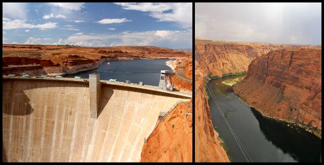
Lake Powell on the north side of Glen Canyon Dam and the Colorado River on the south side.
Tours of dams are always interesting to me and this one was no different. The structure itself is an engineering marvel. It is 300 feet thick at the base and just 25 feet thick at the crest which explains why it took over 4.9 million cubic yards of concrete to build it. Using water to generate electricity is pure genius - and the Glen Canyon power plant generates enough energy to supply 425,000 households with electricity for one year. I am a visual learner so seeing both how the dam was engineered and built as well as how the electricity is "made" helped me understand both.
We took a very fast elevator inside the dam down to the bottom. As soon as we stepped off the elevator, the air was much, much cooler from the cold water at the bottom of the lake transferring its heat (or lack of!) through the concrete. We eventually walked out the front side of the dam to the power plant.
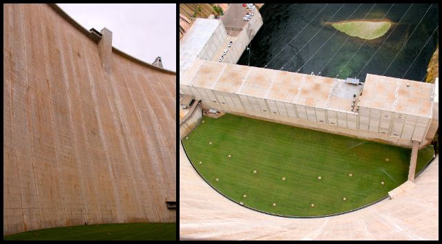
View from the bottom and the top of the dam. The grass was planted to keep the dirt from blowing around - kind of looks like a golf course! Our guide told us some workers hit a few golf balls on it for stress relief! And yes, they use lake water to water it.
After walking around the lawn, we went inside the power plant. Our guide explained how the eight generators work.
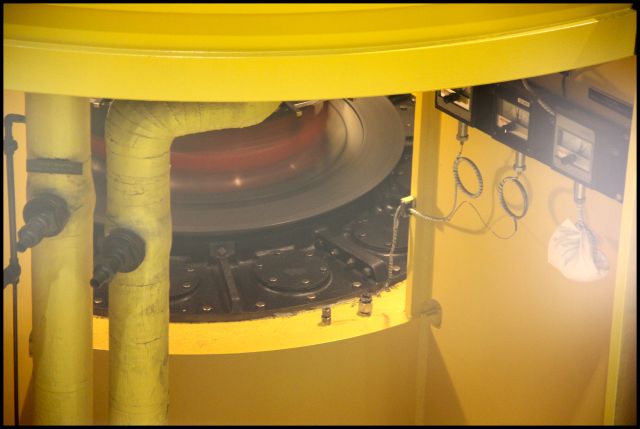
They run as many generators as they need to for the electricity demand. This one was whirring so fast we couldn't see it move, it's just a blur.
Lake Powell is named after John Wesley Powell, the one-armed Civil War veteran who charted the Colorado River through Arizona in a wooden boat. This man-made lake (reservoir) is made by the Glen Canyon Dam backing up the water in the Colorado River and its tributaries (the San Juan River, for example). The dam was completed in 1963 but it wasn't until 1980 that it was "filled!" And only about a fifth of the lake lies in Arizona; the rest is in Utah.
Besides being a "water storage container" to help manage our water supply and a means of generating electricity, it is also a major recreational area attracting more than three million visitors annually. Sandstone canyons, beautiful beaches, thousands of miles of shoreline and warm water make it a destination for house-boaters, speed-boaters and everything in-between.
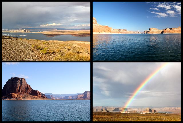
We drove around the southern tip of the lake and it was pretty but its true beauty is revealed when you're on the lake!
Boaters can use Lake Powell to "cross the Colorado River" in Arizona but what do land vehicles use? Glen Canyon Bridge was completed in 1959 to carry building materials for the dam across the river. It is a continuation of US-89 which pushes on for a couple of miles before crossing into Utah.
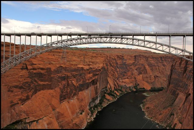
Glen Canyon Bridge is 700 feet above the river and at the time of its completion, was the highest arch bridge in the world. You can see how the high walls of Glen Canyon and the wide expanse of the Colorado River create an almost impenetrable barrier.
Arizona separated from the New Mexico Territory and became its own US territory in 1863. At that time, there was NO WAY to cross the Colorado River leaving the area north of the river (now called the Arizona Strip) cut off from the rest of the territory. Residents often knew more about what was going on in Utah or Nevada than they did their own territory.
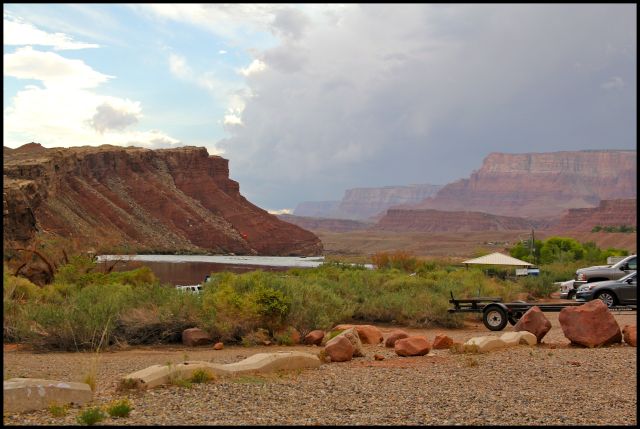
The area was heavily settled by the Mormon Church which quickly realized that a reliable river crossing would help their expansion into the rest of the Arizona Territory. They sent men, supplies and a ferry operator named John D. Lee to a remote outpost where the Paria River flows into the Colorado River; where there is a brief interruption in the canyon walls separating Glen Canyon from Marble Canyon. It is the only place within hundreds of miles on either side that the canyon walls are mildly sloping rather than violently sheer enabling livestock and wagons to make it to the edge of the river.
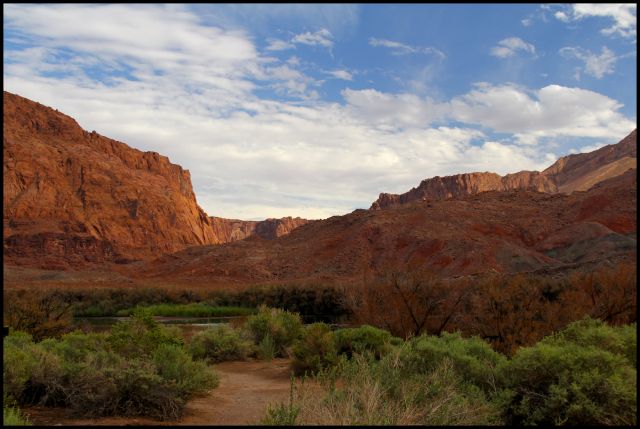
The canyon is noticeably different at the confluence of the two rivers.
By 1873, a ferry operated by John D. Lee was established to cross the Colorado River. It became known as Lees Ferry (#42). A wooden barge-like boat capable of carrying one wagon and team would be loaded and then pulled upstream by men pulling on ropes. The boat was then pushed off from one side of the river (usually the north side) and the current would carry it downstream to the opposite shore. After off-loading the cargo, the ferry would again be pulled by ropes upstream where it would make the return trip to the starting shore. It took a lot of man-power and time to move a group of wagons, livestock and people across the river. And it was not without danger - the river was unpredictable in depth and speed and cargo, people and even the ferry itself were sometimes swept downstream never to be seen again. Once travelers got to the south side, they still needed to make a long, steep, uneven climb out of the canyon. It was not a trip for sissies! Despite the danger and hardship, large expeditions did proceed with the trek making the years from 1876 to 1890 the most active for the ferry operation.
The place known as Lees Ferry is still used today as the launch site for river runners through the Grand Canyon.
The remote outpost became a little boom town before it became a ghost town, particularly once gold was discovered in the cliffs. Unfortunately, the gold was a fine powdery dust that couldn't be extracted so no one struck it rich.

Left: Building used as HQ for a gold mining company (1911) and later as a US Post Office (1922)
Middle: Plaque commemorating Lees Ferry
Right: Lees Ferry Fort built in 1874 by the Mormon Church
The ferry continued to operate into the 1920's. Improvements were made including attaching the ferry to a permanent track cable which would make crossing the river easier and safer. Its final trip was on June 7, 1928 when the boat twisted and capsized while carrying a Model T and two men across the river. All aboard drowned.
By the 1920's pioneer wagon trains were replaced by automobiles carrying tourists and it became apparent that a different crossing was needed. Plans were made to build a bridge several miles downstream from Lees Ferry and construction began in 1927. Since the bridge was almost completed when the ferry capsized, it was decided not to rebuild the ferry but to wait for the bridge to be completed.
Navajo Bridge (#42) on US-89A was completed in 1929 and dedicated on June 15th of that year. At the time, it was an impressive steel arch bridge 467 feet up from the canyon floor. It was 834 feet long and had a load capacity of 22.5 tons.
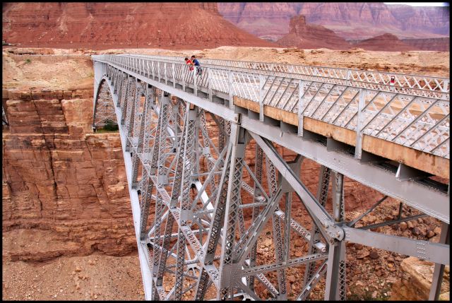
But the really impressive part is that 7,000 people and 1,217 automobiles came to witness the historic event. You see, in 1929 the Panama Canal was open, the Titanic had sunk, and the first trans-Atlantic flight had taken place. But prior to the bridge being built, the ONLY way to cross the Colorado River in Arizona was an antiquated, unreliable ferry system. The bridge was a very big deal. For the first time people could safely and easily travel to the northwest part of the state, to the north rim of the Grand Canyon, for example.
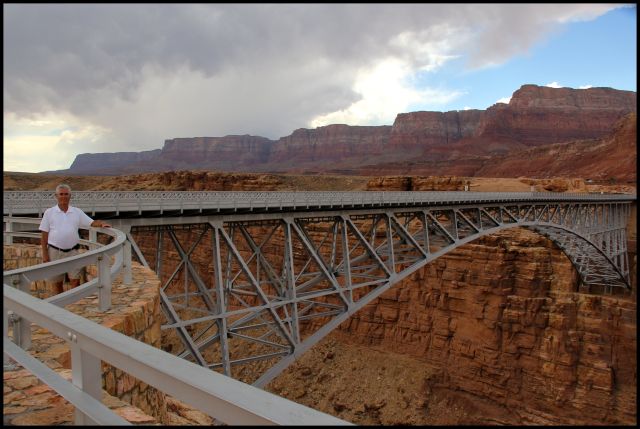
The Navajo Bridge was heavily traveled for over half a century before it was decided in 1990 that the bridge was inadequate for traffic demands. Replacing the bridge was the only way to widen it to increase flow and bring it up to federal highway standards. The new bridge, looking visually similar, would be built next to the old one. The old bridge is now an equestrian/pedestrian bridge.
The new bridge opened in September, 1995. It is 75 feet longer, 3 feet taller and 26 feet wider than the old bridge.
There is a nice interpretive center and viewing areas between the two bridges. As we were viewing the canyon, the bridges and the cliffs in the background, we caught sight of a couple of California condors flying in the thermals and then resting on the cliff tops. They are such majestic-looking birds! California condors were facing extinction when The Peregrine Fund stepped in and began hatching chicks at their World Center for Birds of Prey in Boise, Idaho. The birds are then released to the wild in Arizona. Captive-bred California condors were released for the first time near the Grand Canyon in 1996; those condors are now raising their own wild chicks and foraging north into Utah.
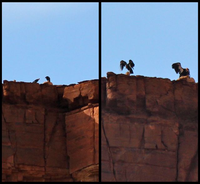
Though they are dwarfed by the cliff, these birds have the largest wingspan (9.8 feet!) of any North American bird and can weigh up to 26 pounds!
The Arizona Strip - that primitive, rugged section of our state cut off from the rest of the state by the unpredictable, wild Colorado River and the deep canyons it cut - has a fascinating history. I can't wait to see what the future holds for it!
Thumb Up or Down: UP for all!!
Miles Round Trip: 887.6 miles
Miles To Date: 9248.3 miles
Percent of List Completed: 83%
Date of This Trip: August 30 - September 3, 2012

No comments:
Post a Comment