I started this blog at the urging of friends and family in April 2010 when my husband and I were given an opportunity to relocate in Maryland for one year. We have now returned home to Arizona and continue to walk by faith as we watch God orchestrate the adventures in our lives. I invite you to share in our adventures as we watch God at work!

We live by faith, not by sight. 2 Corinthians 5:7


Tuesday, September 28

Autumn Journey 2010 ... day eleven (Quebec City)

Although both our children have been to Europe, we have never crossed "the big pond" so we were excited to visit Quebec City and experience some European charm right in our backyard. The province of Quebec has retained its French heritage and although Canada has two official languages, English and French, it is French that is spoken in Quebec. Although founded in 1608 by Samuel de Champlain, Quebec City would not be considered an old city by European standards- yet we were captivated by the old world feel of the city. Champlain named the settlement after a local native word (kébec) meaning "the river narrows here"- an apt description of the St. Lawrence River at Quebec City.

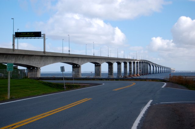
We awoke to an overcast sky and light drizzle but didn't let that dampen our spirits as we headed out to explore the city on foot. Quebec City is situated on Cape Diamond, a promontory  edged by a sheer cliff that rises 300 feet above the St. Lawrence River. The city is divided into Lower Town at the base of the cliff and Upper Town on top of the cliff. The old, historic walled city (the only walled city left in North America) is in Upper Town. Modern residential and commercial areas spread out along the river valley. Our hotel was in Lower Town so we began by walking up...

Architecture collage
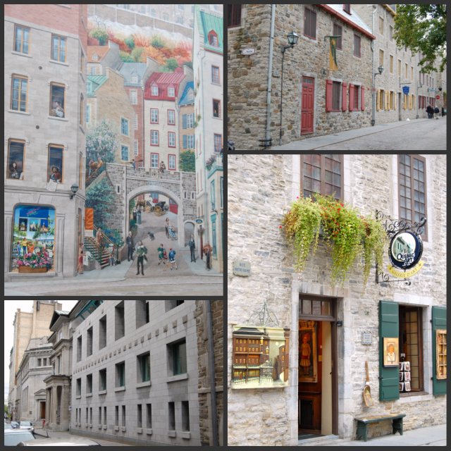
I love the clean lines of the block buildings next to the roughness of the stone buildings. The streets are lined with quaint houses and businesses with the buildings butting up against each other. A few blocks from our hotel, before we started the big climb UP, we passed a building with a huge mural (upper left photo) on the side. The four seasons are depicted as well as life in Quebec City.

The winding road to Upper Town is steep and narrow. It is also lined with shops and restaurants so there are a lot of things to stop and look at making the long climb more enjoyable.

Steep Streets collage
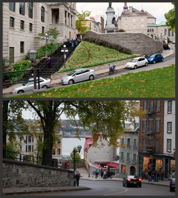
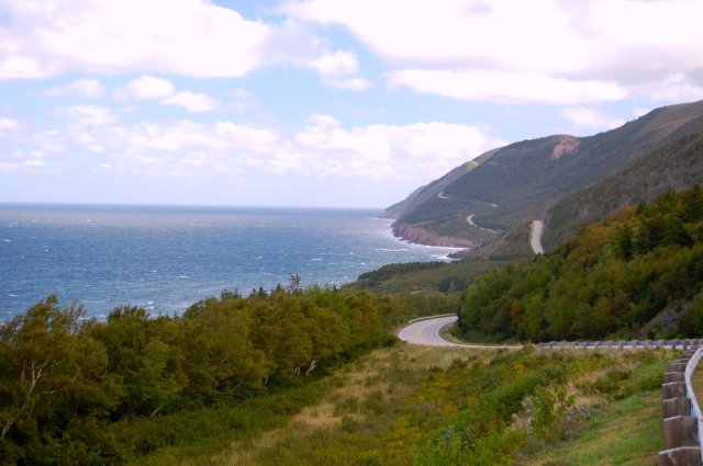
None of the pictures do justice to the steepness of the streets- a definite defensive advantage! 

After a little huffing and puffing we finally made it to what I thought was "the top." We walked around the small park area admiring the view and inspecting a portion of the wall. The people below us looked very small- the photo on the top right is NOT an optical illusion!

Park collage
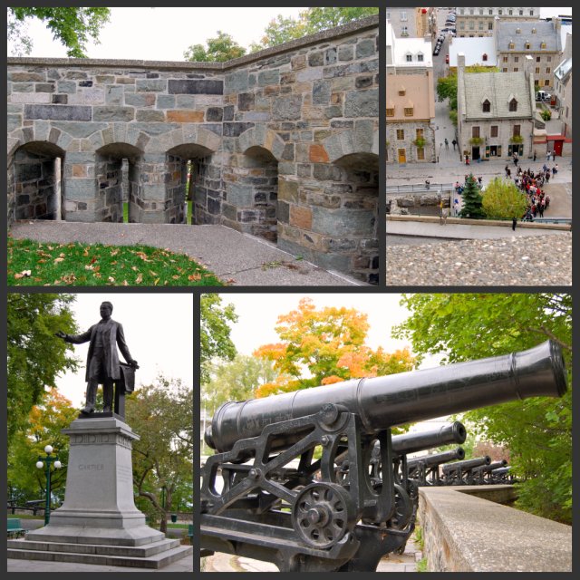
Cannons, looking quite menacing, lined the wall at the high ground of the park area while a taller wall with long open slits to poke muskets/rifles out of wrapped around the lower ground. It was easy to imagine soldiers manning their posts, waiting for an attack. In the middle of the park were benches, pigeons and statues... things you would see in any park in any city on a peaceful day. The contrast was stark.

We continued walking uphill past homes, shops, cafes, restaurants and outdoor vendors. Although the houses and shops are all connected- in other words, "row houses"- each one is distinct with its own charm and character. It would seem that having each one painted a different color would make a chaotic mess but they really blend together with harmony and beauty to create unity. It reminded me of the unity that God's people share despite coming from different ethnicity, financial means, social status, giftedness, talents and jobs.

Houses collage
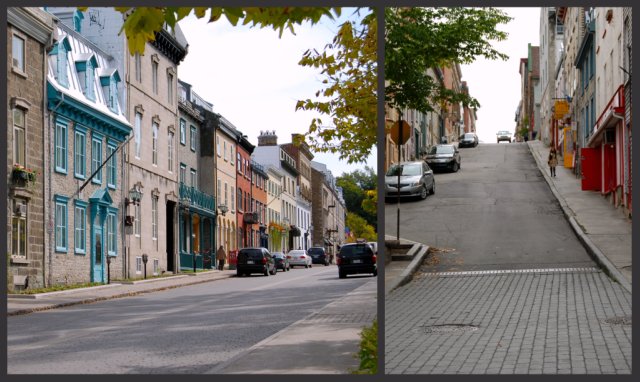
Some of the row houses looked like single family homes, others looked like they had been converted into two or three apartments. All of them looked vintage!

I mentioned Quebec City's geography as well as the wall earlier. The jagged cliffs provide an excellent natural defense against invaders. The first wall was built in the latter 1600's under French rule. The project started and stopped many times before it was completed as a true fortification in the mid-1700's. The wall has been restored and stabilized several times with great respect given to maintaining the original structures; the wall is authentic. But just a high wall does not make a good fortification (enceinte)- a wide ditch, covered path and glacis (a gentle slope that concealed the wall from intruders) were also utilized. The buildings that are close to the outside of the wall today are much newer- built in the latter 1800's after the fortification was no longer needed.

The French were not expecting the British to attack by scaling the cliffs but that's exactly what they did in 1759 when British soldiers captured the city. The Treaty of Paris was signed in 1763 and the King of France ceded to the British Crown "Canada and all its dependencies." Then the United States attacked Quebec TWICE! The first time was in 1775-76 when American Revolutionary War soldiers, wanting to liberate the captive French (since Quebec was now a British colony), tried to invade Quebec. The Americans were defeated in the Battle of Quebec in 1776. Later, in the War of 1812, the United States declared war on Great Britain and attacked its colony, Canada, over westward expansion. The Americans were again defeated and Quebec remained under British rule. By the end of the 1800's, Quebec had decided their fortification was not needed. Gates were installed to allow citizens to pass freely through the city and buildings began cropping up near the wall.

Wall collage
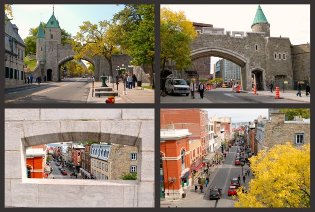
The two top photos are the same gate from different sides of the street. The two bottom photos are taken from the top of the gate. As I walked up the stairs to the top of the gate I couldn't help but think of the many soldiers who had walked there before me.

Realizing that they barely defeated the Americans earlier, the British began building a star-shaped fort in 1820 on the highest point of Cape Diamond in anticipation of renewed attacks by the Americans after the War of 1812. "La Citadelle" was completed in 1851 but ironically was never attacked by the Americans or anyone else. The Citadel covers 37 acres and is the largest North American fort still occupied by troops.

Citadel collage
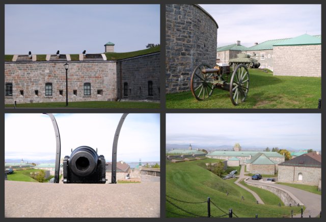
The top left photo shows the outside wall facing the city. I thought it was interesting that the Citadel was built to serve as a refuge for authorities and British troops if the French inhabitants of the city tried to revolt as well as to defend the city against invaders.  

After all this walking around, we needed an afternoon pick-me-up...

Coffee collage
... and what could be more French than indulging in a latte and crème brûlée at an outdoor cafe!

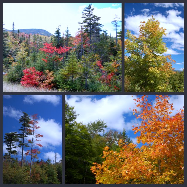
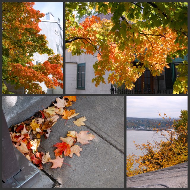
Although we didn't get to see the changing of the guard at the Citadel (they only do that during the summer for the tourists), we did get to see many trees changing color. 

Leaves collage


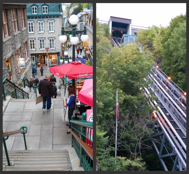
We walked up and down the streets of Old Quebec City. Most of the streets are built with an incline but some of the strictly pedestrian streets are terraced with stairs going from level to level. There is also a funicular  (or incline railway) to move people up and down. 

Up and Down collage


As dusk approached, we stopped at a French restaurant for dinner. The weather was beautiful and we elected to dine outside. 

Dinner
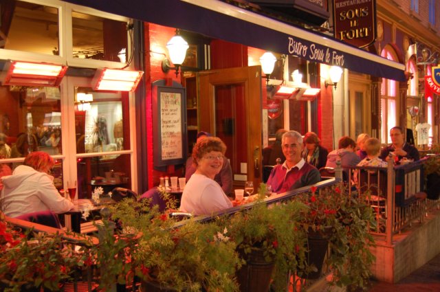
I asked the woman sitting at the table next to us to take our picture. That started a conversation with her and her husband that lasted through dinner. They had just completed a cruise and were returning home to Indianapolis the next day. After hearing French or French-accented English all day, it was delightful to hear good ol' American English again!

It was a wonderful day exploring Quebec City- soaking up the French influences and local color. After we returned to our hotel, we discovered we had walked a little over six miles as we explored the city. No wonder my feet hurt!

Monday, September 27

Autumn Journey 2010 ... day ten, the longest day

We left Prince Edward Island bright and early on Sunday, September 26th. We had a long drive ahead of us before we reached Quebec City, Quebec, our final Canadian destination. A final stop at the PEI Starbucks was in order before we crossed the Confederation Bridge into New Brunswick.

As soon as we crossed into New Brunswick, we noticed that the fall color had erupted since we were there just a week before. We oohed and aahed at every turn in the road as the sunlight danced upon the trees making the leaves brighten before hiding behind a cloud making the colors deeper, richer. We stopped to take pictures, each time thinking that stop held the "best view" only to find out there was an even better one just down the road. After taking 77 pictures (two or three per stop) of TREES, we decided that had to stop or we would never get to Quebec City.

Tree 1
OOH and AHH!

How many crayons are in your crayon box? I think women have the telescoping tower of 150 crayons while men have the basic box of eight crayons. I asked Richard to name the colors of the leaves we were looking at as we drove. "Red, orange, yellow, green" he said as he looked at me like I was crazy. "Be more descriptive... like 'mahogany'" I replied. He looked at me like I asked him to recite the Declaration of Independence in Swahili. Finally, after much encouragement, he came up with a few- "Caution Sign Yellow" and "Unripe Banana" and "Cinnamon Candy Red"...

Tree 2
How about fiery copper, crimson, pumpkin orange, goldenrod, ASU maroon and gold (yep, that was mine, not Richard's!), persimmon, ginger, spruce green, brick red, sage green, burnt sienna, chestnut, mango, mulberry, scarlet, sunset orange, ...

After exhausting the color topic we began talking about where we would want to live if we ever had to be placed in the Witness Protection Program. I thought someplace with seasons would be good. This led to a discussion of jobs we could do there... Richard could be a computer geek helping the elderly set up their computers and I could run a photography business. Oh wait, now it's not a secret.  Anyway, this passed an hour or two.

We finally came to Hartland, New Brunswick- the smallest town in New Brunswick with a population of a little over 900. The amazing thing about this town, which is situated on the St. John River, is that the citizens on both sides of the river formed the Hartland Bridge Company in 1899 for the express purpose of building a bridge across the river since it was taking the government too long to decide if they were going to build a bridge or not. The 1,282 foot long bridge is the longest covered bridge in the world and was completed in 1901. The bridge was purchased by the government of New Brunswick in 1906 and is still open to vehicle and pedestrian traffic today.

Hartland Bridge
The Hartland Covered Bridge was a popular kissing bridge for many years since it is so long!

As we continued our drive along TransCanada 2 (New Brunswick) we noticed numerous signs warning us to be on the lookout for moose. Then we noticed the "moose fence" along both sides of the highway. Apparently this section of the highway has had many moose/vehicle collisions, often with deadly results for the vehicle occupants. The fence was constructed to keep the moose off the highway. Every so often we would see a gate for humans as well as a gate for the moose. Yes, seriously!

Moose Fence collage
The moose gate is constructed so that the moose can easily go in if they find themselves outside the fence, but cannot get out from inside the fenced area. So we wondered- how do the moose get out?

At long last, after it got dark, we drove into Quebec City. Miles driven today- 600.7 miles. Moose spotted- ZERO!

Sunday, September 26

Autumn Journey 2010 ... days eight and nine (Prince Edward Island)

All too soon it was time to leave Cape Breton Island, cross the causeway back to mainland Nova Scotia and board the ferry for Prince Edward Island. For those who are as geographically challenged as me, the province of PEI is an island off the eastern coast of Canada surrounded by Nova Scotia, New Brunswick, Quebec, and Newfoundland in the Gulf of St. Lawrence. The capital city, Charlottetown, is a busy port where cruise ships frequently dock.

PEI is known for its beaches and lighthouses. There are 500 miles of the warmest beaches north of the Carolinas on PEI. Although it was too chilly for playing in the water, we did enjoy walking around a beach or two. The sand is soft and often reddish in color. Dozens of lighthouses dot the coast and we visited several. My favorite was Cape Bear Lighthouse (built in 1881) on the southeast tip of the island. Two things make this lighthouse unique: 1) it is a three-story square structure (quite unusual) and 2) it was the first Canadian land station to hear the SOS distress call of the Titanic as she sank in 1912.

Beach/Cape Fear collage
Much of the island is sandstone giving the beaches and cliffs their reddish color.
Cape Bear Lighthouse

After a long ferry ride, driving around and exploring lighthouses, we were ready to check into our next Bed & Breakfast, the Charlotte's Rose Inn in Charlottetown. The original Victorian home was built in 1884 and has seen 5 major additions/remodels while keeping the Victorian charm. Our hosts, John and Maureen Crofts, were simply wonderful- great cooks, knowledgeable tour guides and very personable.

Charlotte's Rose B&B collage
We stayed in the Jacques Cartier room. I loved the handmade quilt at the foot of our bed. The footed bathtub, while beautiful to look at was a bit difficult to shower in!

The next day we walked around Charlottetown admiring the architecture and mix of old and new. Several quaint shops line the main street as well as row houses turned into Bed & Breakfasts. After getting coffee at Starbucks (the only one in PEI and one of 1068 in all of Canada- compared with over 11,000 in the US... but that's another blog topic!), we headed out to explore the island.

There is an island saying that all roads lead to Charlottetown... and it certainly seemed so as we drove to Cavendish to see "the house of Green Gables." The roads twisted and turned and even with a map it was difficult to know for sure where we were. Every road seemed to be a way to get to Charlottetown as we saw signs with mileage markers for the capital city on nearly every street we ended up on. Finally, we made our way to Cavendish and learned about PEI's famed author, Lucy Maud Montgomery and her beloved book, Anne of Green Gables.

Born in 1874 in a modest house in Cavendish (PEI), Maud (as she was called) was raised by her very strict maternal grandparents after her mother died when she was not quite two years old. Receiving no emotional support or love from her grandparents, Maud retreated into a "literary fantasy world" making up stories about people, places or even things. Her aunt and uncle lived nearby and she soon was spending much of her time there with her cousins. It was their rambling farm house that was the inspiration for "Green Gables." Maud was a teacher, a poet, a hymn writer, an assistant postmaster and a proof reader for a Halifax newspaper before beginning her writing career in earnest. She wrote Anne of Green Gables in 1904, but her manuscript was rejected by several publishing companies before finally being published in 1908. The book was quite popular and became an overnight success. I reread it on this trip and loved it even more than I did the first time I read it as a child.

Green Gables- ed 1
"She (Anne) opened her eyes and looked about her. They were on the crest of a hill. The sun had set some time since, but the landscape was still clear in the mellow afterlight. To the west a dark church spire rose up against a marigold sky. Below was a little valley and beyond a long gently-rising slope with snug farmsteads scattered along it. From one to another the child's eyes darted, eager and wistful. At last they lingered on one away to the left, far back from the road, dimly white with blossoming trees in the twilight of the surrounding woods. Over it, in the stainless southwest sky, a great crystal-white star was shining like a lamp of guidance and promise. "That's it, isn't it?" she said, pointing."
(from Anne of Green Gables)

Lover's Lane- ed 1
"Lover's Lane opened out below the orchard at Green Gables and stretched far up into the woods to the end of the Cuthbert farm. It was the way by which the cows were taken to the back pasture and the wood hauled home in the winter. Anne had named it Lover's Lane before she had been a month at Green Gables."
(from Anne of Green Gables)

Tea Set
"'Oh, Marilla!' Anne clasped her hands. 'How perfectly lovely! You are able to imagine things after all or else you'd never have understood how I've longed for that very thing. It will seem so nice and grown-uppish. No fear of me forgetting to put the tea to draw when I have company. Oh, Marilla, can I use the rosebud spray tea set?'"
(from Anne of Green Gables)

GG Bedroom
"It was broad daylight when Anne awoke and sat up in bed, starring confusedly at the window through which a flood of cheery sunshine was pouring and outside of which something white and feathery waved across glimpses of blue sky."
(from Anne of Green Gables)

PEI is an agrarian province. The fertile soil and relatively warm climate make it ideal for growing many crops and dairy farms abound. We passed herd after herd of Holsteins, many of them grazing in unfenced pastures with views of the ocean. I swear these cows were SMILING! It has been said that happy cows live in California... PEI has ecstatic cows!

Cows
Cows Ice Cream was founded in Cavendish, PEI in 1983. All of their ice cream is still produced in PEI which perhaps explains why they were voted #1 in "World's Top 10 Places for Ice Cream" by Tauck World Discovery as well as "Canada's Best Ice Cream" in a Reader's Digest opinion poll. We sampled their ice cream twice... quite de-lish!!

It is true there are no moose on PEI so the moose hunt was temporarily suspended. In fact, we didn't see any animals of the mammal variety except the aforementioned cows and the occasional dog.  But they do have some beautiful birds.

Bird collage 2
The Great Blue Heron was majestic to watch... so beautiful and graceful. And the Bald Eagle we spied on the treetop was quite regal-looking.

I said earlier that we took the ferry to PEI. There are two ways on and off the island- the ferry and Confederation Bridge. There is no toll or charge to get ON the island, but there is a hefty toll or charge to get OFF! The ferry takes about an hour and a half and costs $74 per car (passengers included) whereas Confederation Bridge takes 10-12 minutes to cross with a toll of $42.50 per car. So... why would anyone take the ferry? If it's the direction you want to go or you just like riding on boats. We took the bridge when our time in PEI was over.

Confederation Bridge
At eight miles long, the curved Confederation Bridge is the longest in the world crossing ice-covered water.

Autumn Journey 2010 ... days six and seven (Cape Breton)

For those of you who don't know Canadian geography, Cape Breton Island is a large island that forms the north-eastern part of the province of Nova Scotia. The people who live there are mostly descendants of Scottish immigrants along with some French settlers (now called Acadians) and the native inhabitants of the area, the Miq Macs. Celtic music is heard everywhere and until a few years ago, Gaelic was taught in the schools. It is a cultural experience not to be missed!

So, how do you get there? The Canso Causeway is the only road for cars to get to the island. It has a swivel bridge to let boats through... which of course, ties up traffic in both directions.

Canso Causeway
One woman we talked with said traffic on the causeway was stopped during Hurricane Igor, presumably due to high waves coming across.

The first night we drove up the northwestern side of the Cabot Trail and stopped just outside Cape Breton Highlands National Park. We were treated to another gorgeous sunset over the Gulf of St. Lawrence.

Cape Breton Sunset
I could get used to this!

The next morning we were up early to make the most of our time in the park. We passed this patch of "scarecrows" one of the locals puts up every year for the tourists... we thought they looked like something out of "Night of the Living Dead!"

Scarecrow People
Interesting folks!

Finally we were in the park and after receiving warnings about bears, coyotes and moose from the ranger, we were off. The road zigged and zagged as it made a very steep climb. Off to our left the Gulf of St. Lawrence sparkled as the sun peaked out from the clouds.

Cabot Trail Road
Those in our family will immediately recognize this as a "Nona Road!"

We made our way to the top of French Mountain and set out for a 5+ mile hike on the Skyline Trail. The beginning of the trail was mostly flat and had beautiful views of fall foliage. We saw a moose track- but no moose... or bears... or coyotes... or any other animals.

Skyline Hike #1
We occasionally caught glimpses of the blue water through the trees as we continued along the path. This portion of the hike was relatively sheltered in the trees and we took our outer jackets off. It was very quiet... not even the chirping of birds or rustling of squirrels in the underbrush. 

Skyline Hike #2
We could see the sparkling water off in the distance... and wildflowers still bloomed!

Skyline Hike #3
We finally reached the boardwalk- a wooden walkway through the boggy areas and fragile ecosystems as we approached the end of the hike. Holy cow!! What breathtaking views! It was very windy on the boardwalk and at times it felt like we would be blown right off the side of the mountain. There were no guard rails (just a sign at the bottom that said you were responsible for your own safety- gotta love Canadians!) as we descended the 96 steps to the final view point. We sat on a bench and admired the view for awhile before beginning the hike back. Yep... it started with climbing up the 96 steps and then the uphill hike back... but it was so worth it!

We drove a ways further along the Cabot Trail before stopping to have our picnic lunch- a sandwich we purchased at Tim Horton's (think DD) when we got breakfast. As we sat at a picnic table munching away, we watched a little dark brown field mouse scurry from tree to tree. Fortunately he scurried away from us so I did not end up ON the table! After lunch, we hiked a little over a mile to a waterfall on MacIntosh Brook. We meandered through stands of white-trunked birch trees and over the brook several times before we were rewarded with a beautiful waterfall cascading down the rocks.

Waterfall Hike
The path on the right side of the brook was covered with exposed tree roots (stumbling hazard) while the path on the left side was worse- boulders in places to climb over and a tree trunk lying across the path! But, again, it was worth the effort!

We continued along the Cabot Trail where every turn was a feast for our eyes. The views were spectacular... the shimmering Gulf of St. Lawrence and Atlantic Ocean (on the eastern side of the Cabot Trail), the fall foliage, the jagged rocks at the bottom of steep cliffs, the powerful waves crashing against the rocks. Finally we arrived at our destination for the night on the southeast side of the Cabot Trail, the English Country Garden Bed & Breakfast.

English Country Garden BB
The house sits on 37 acres with a lake to the side. Ian and Penny were wonderful hosts- we felt at home immediately.

English Country Inn BB #2
Our room, the Conservatory Room, was magnificent. I think Richard found it a little too girly, but I loved it. The attention to detail was amazing- from antique touches  to toiletries in the bathroom to the most comfortable chair I've ever sat in. My favorite thing, though, was the bathtub. It was exactly what I needed after hiking all day! Ian fixed us a delightful salmon dinner served on the enclosed porch- very romantic!

Our stay on Cape Breton Island only deepened my love affair with Nova Scotia. I cannot wait to come back for another visit!

Wednesday, September 22

Autumn Journey 2010 ... day five

Do you have a mental picture of what Nova Scotia looks like without ever having seen it? I did... and it looks just like I imagined it would. Beautiful blue water (lakes and ocean), wooded areas and forests, fishing boats, lighthouses and small villages. Yep, it looks like a Fisherman's Friend cough drop commercial!

Water View
The granite boulders were left behind when glaciers carved out the area eons ago. They provide places for the shore birds to perch... as well as being beautiful to look at!

Fishing Boats
Peggy's Cove is a little fishing community on the Atlantic Ocean. There are fishing communities all around the coastline- it's one of their major industries. Fresh fish = YUM!!!!

View of Houses
Everyone, and I mean everyone, has lobster traps (like the ones on the deck in the foreground) even if they don't do any other fishing.

Village
The villages are very tight-knit communities where the people know their neighbors and help each other. What I didn't expect was how friendly to strangers the people are... as they say, "It's the maritime way!" We talked with several locals- and the first thing they want to know is where we are from... I think they think we have an accent!

Lighthouse
The Peggy's Cove Lighthouse is built on granite boulders. The water around the rocks is very shallow and produces tremendous waves along the rocky shore.


I think I've fallen in love with Nova Scotia... must be the Scottish blood in me!

Tuesday, September 21

Autumn Journey 2010 ... day four

Have you ever had a day where everything reminds you of God and His attributes? Today was just such a day.

A co-worker told Richard that we had to see Hopewell Rocks while we were in New Brunswick. They are located in the Bay of Fundy, a funnel-shaped body of water. The gradual narrowing and shallowing of the water constricts the tidal flow into the  bay causing the highest tides found anywhere in the world. Other places have an average high tide range of about 3 feet; the Bay of Fundy's is 52 feet at the head of the bay. Today, at Hopewell Rocks,  the tidal range was 27 feet. Not being a surfer or oceanographer, this meant nothing to me until I saw it.

High tide today was at 10:50 this morning and we arrived shortly before that. The half mile walk out to the rocks was invigorating and we arrived just as the fog was lifting. Looking down on the rocks from the lookout point was... well frankly, like looking at the ocean from any other lookout point. The rocks were pretty and the water was rising- nothing very spectacular. We left the park to see some other sights and then returned for low tide at 5:20pm. Instead of just looking down from the lookout point, we walked down 96 steps to the ocean floor and WALKED ON THE FLOOR OF THE OCEAN! The water was gone... it was amazing!

Hopewell Rocks 1 collage
The flow of ALL the rivers in the world doesn't equal the flow of water going into and out of the Bay of Fundy! The water by the two flowerpot rocks on the left was about 9 or 10 feet deep in the left picture, and has receded much more than that as you can tell from the right picture.

Hopewell Rocks 2 collage
Standing under the rocks made me realize how insignificant I am in comparison to our mighty God who designed the earth, the oceans and the tides. As the park ranger told us, changing just one little thing completely changes the ecosystem and can destroy an entire species. 

We went to Cape Enrage in between the tides. The lighthouse there is one of several we've seen on this trip but walking around this particular lighthouse, gazing at the rocks below and imagining the ferocious storms that give this place its name, made me think about God's grace. We experience storms- financial problems, relationship issues, mourning the loss of a loved one, ...- during our life but God's Word is our beacon, lighting our path and steering us away from the rocky shore and shifting sand just as the lighthouse is a beacon to ships warning of them of unsafe waters and guiding them around the rough water.

Cape Enrage lighthouse
"Your word is a lamp to my feet and a light for my path."  Psalm 199:105

Later in the evening as we were driving to Nova Scotia, we saw the most beautiful sunset I've seen in a long time. The sky turned light pink, then darkened and eventually turned bright orange-red. It looked like the sky was on fire... in fact, Richard said it reminded him of the old Voyage to the Bottom of the Sea movie (1961) where the sky is on fire.

Sunset
"The heavens proclaim the glory of God. The skies display his craftsmanship. Day after day they continue to speak; night after night they make him known. They speak without a wound or word; their voice is never heard. Yet their message has gone throughout the earth; and their words to all the world."  Psalm 19:1-4

Autumn Journey 2010 ... day three

Sometimes I forget to take time to smell the roses. I get distracted by the busyness of life but vacation is the perfect opportunity to adjust both my thinking and my priorities. Often it's the little things that can make a good day even better.

Fall Color 3 collage
A foggy morning as we left Bangor, Maine made the colors of the trees both vibrant and muted at the same time. The forests looked so peaceful and inviting.

flower collage
And then we'd see patches of wildflowers still blooming. Of course, they were often hidden in patches of brown weeds or very low to the ground- you had to look for them. It reminded me that beauty is all around us if we only look for it.

We went through Canadian Customs at St. Stephen, New Brunswick. The border crossing was not at all busy and our Customs agent was very friendly. I love Canadians and the way they speak... the upspeak at the end of sentences and their word choices. We aren't on vacation, we are "on holiday." And we aren't on a road trip, we're "touring."

We stopped at some covered bridges and lighthouses as we slowly made our way up the coast to our destination for the night- the Innisfree Bed & Breakfast.

Innisfree B&B collage
Our hosts, Alan and Elaine Demaline, were quite hospitable and made us feel right at home in their home. The main part of the house was built in 1847 with several more rooms added on later.

Innisfree room collage
We stayed in The Prospector room (named for one of their favorites, the popular Chestnut Prospector canoe, since they're avid canoers/kayakers)- a delightful suite with wood floors, thick quilts and furnished in antiques. It was very comfortable (like the canoe!) and we wished we could stay longer!

B&B garden collage
The house is situated on 10 acres of gardens and an apple orchard. Elaine makes her own apple jam and her home-made granola is the best I've ever had. There are plenty of places to sit and relax, trails to walk and a stream. I loved the view outside our window!

Yep, it was a most excellent day!

Saturday, September 18

Autumn Journey 2010 ... day two

Today was a fabulous day! We watched the sky cloud up and threaten to rain, then clear up almost completely before getting cloudy and quite foggy to be followed by partly cloudy skies with patches of blue. We drove through mountainous areas with trees of gold, orange and red and then plains where the trees were just beginning to change color. We drove through many small towns in Vermont, New Hampshire and Maine where Main Street was lined with American flags and signs paying tribute to our troops were everywhere. Here is a glimpse of our memorable day.

Trees collage
To all my Arizona friends: This is what fall looks like. As we turned a rounded a bend and the sun hit the trees, it looked like some were ablaze with fire while ones right next to them were totally unscathed.

Bridges collage
There are two things New England is well-known for... fall foliage and covered bridges. The top photo is the longest covered bridge in the United States and spans the Connecticut River separating Vermont and New Hampshire. The middle photo is of the Honeymoon Bridge (so named because of the long-standing tradition of newly married couples posing for pictures by the bridge) in New Hampshire- it has a pedestrian walkway inside it. And the lower photo is of the Artist's Covered Bridge in Maine- so named because it is the most photographed and painted bridge in all of Maine. In fact, when we arrived the interior of the bridge was set up for a wedding and the bride and groom were posing for photographs! This bridge is no longer used for traffic.


Mis Moose
While we were driving down a two lane road in New Hampshire we repeatedly saw signs for "Moose Crossings" and to "Watch out for Moose." I was scanning the sides of the road for a moose as we munched on some Raisinettes when I spotted one off to the side. With my mouth full I yelled, "Moof" which Richard properly understood and quickly pulled the car over to the side. We walked back to the area where the moose (I presume Miss Moose since there were no antlers) was munching grass. This was the best picture I got before someone passing by honked their horn and Miss Moose ran back into the woods.

R&K collage
Just so you know we are really on this vacation!
Today's mileage was 407.5 miles.